

4.5 Average Rating - Highest Among Offroad Trail Guides
What is a trail guide.
Find 4WD trails near you and across the country. Quickly understand trail difficulty with our color-coded tracks to find the perfect trail for you.

Understand trail difficulty with a numerical technical rating, vehicle recommendation, list of concerns, and written rating summary.

Marked locations for obstacles, points of interest, directional turns, camping, and more. Each Waypoint includes 3 photos and a description. Additional camping regulations, permitting, and details are also outlined.

Every trail guide comes with a short video, filmed by the author, to help you gain a reference point of what the trail is all about.

Member trail reviews provide dated information and photos of trail conditions. Votes are cast toward the Community Consensus to help keep difficulty ratings correct and alert Trails Offroad to necessary updates.

Download an entire state on your mobile device with a single tap. Trail guides and base map information will be available even when cell signal is not.

The perfect partner to the Trails Offroad mobile app. Connect to your CarPlay compatible vehicle and launch Trails Offroad on your in-dash headunit for a guided on-trail experience.

What People are Saying
Simply the best. forget the rest, i highly recommend, featured on.
Become a Trails Offroad Member

All-Access Member
$39.99 / year, free account, our favorite trails.

Imogene Pass

Yankee Hill Road

Engineer Pass Road

Medano Pass

Rampart Range Road

Fins and Things

Kingston Peak

Broken Arrow

Tincup Pass

Black Bear Pass

Schnebly Hill Road

2N02 - Burns Canyon

3N69 – Gold Mountain

Maple Springs Road

Georgia Pass

3N16 - Holcomb Valley

Hell's Revenge

Cinnamon Pass

Coney Creek Road (aka Coney Flats)

NF-7030 to Stampede Pass

Chicken Corners

Middle St. Vrain

Top of the World

Kelly Flats

Mojave Road

Mount Baldy

Berdoo Canyon

Poughkeepsie Gulch

Backway to Crown King

3N10 – John Bull

Box Canyon - Florence

Fish Creek Trail - Anza Borrego

Poison Spider Mesa

3N93 - Holcomb Creek Trail

Barlow Trail

Elephant Hill

Talladega National Forest 600-1

The Rubicon Trail

Bennett Pass Road

Tray Mountain Road

Toquerville Falls

Cedar Tree / Tillamook State Forest

Bald Mountain Gulch

Holy Cross City

Naches Trail

Transfer Trail

Bloody Basin Road

Peters Mill Run

Gold Fever Trail

Log Corral Trail

Rocky Gap/Potato Ridge Road

Chamisoso Canyon

Forest Service Road 333

Black Gap Road

Skidmore Fork/Dunkle Hollow Road

26E212 - Red Lake Trail

Horse Pasture Road

Flagpole Knob

Elberta Slant Road

Steel Bender

Redington Pass

The Barracks Trail

Carwash Falls

Odessa Canyon

Dusy-Ershim Trail

Wheeler Pass

Crown King Road

Pinyon Mountain Road

Fordyce Jeep Trail

Corbin Creek Road

Hungry Valley SVRA - Pronghorn Trail

The Bradshaw Trail

Kebler Pass

Firebreak Five / Tillamook State Forest

Sledge Hammer

Mary Ellen Gulch

Butterfield Canyon

Metal Masher

Bald Mountain Jeep Trail aka Big Levels

Rattlesnake

Tread Lightly! Four Wheel Drive Way

Alabama Hills - Movie Flat (Area)

Table Mesa Road - West

Bitter Springs Back Country Byway

Potts Mountain Jeep Trail

Devil's Racetrack

Blanca Peak

Elvis Trail

Golden Spike

Canaan Loop Road

Snake F19 - Hot Springs ORV Park

Dickey Bell

Gravelly Range

PeeWee Crossing - Southern Missouri Off-Road Ranch

93C - Nicholson Gap

Telegraph Line Trail

Knoxville Devilhead Road

93D - Bridge Gap

Guard Rail - Southern Missouri Off-Road Ranch

El Camino del Diablo

Quebradas Backcountry Byway

Spaas Creek

Cliff Hanger

Padre Island National Seashore

Windrock 51: Panther Rock

Rubicon Ridge D1 - Hot Springs ORV Park

Hidden Falls Adventure Park: Outer Loop

93G - Nelson Cove

Hole in the Rock Trail

Jericho Mountain Green Trail - East

Silver Lake Sand Dunes

Denali Highway

Monument Ridge

Pritchett Canyon

Jericho Mountain Green Trail - West

Oro Plata Mine

Gandy Dancer State Trail

Windrock 22

93A - Access

Oceano Dunes SRVA aka Pismo Beach

Fun Run G3 - Hot Springs ORV Park

Turkey Bay OHV Primary Yellow 01

Bolivar Peninsula

93B - Blue Rock Mountain

Robledo Loop

Pumpkin Hollow Road

Main Park Road

Nip and Tuck Road

South Marblehead Loop

Main Road 5 - Hot Springs ORV Park

Wards Hollow - TWP 427

Wild Bill - Eagle Mountain Trail aka Blacktail-Wild Bill ORV Trail System

Osceola - FR235

Ocala - Forest Road 09

Cape Lookout

Rausch Creek Off Road Park: 11

Windrock 26

Bearwallow: Outer Green Loop

Bearwallow 76: The Cooler

Stony Lonesome 404

Holly Oaks ORV Park: Lower Main Loop

Gulches ORV Park: Arrowhead Alley

Washington Quaker Bridge Road

Windrock 16

Gulches ORV Park: River Road

Wild Bill - Truman Creek

Two Hearted Landing

Bearwallow 45: Deadfall

Canyon Rim Road

Rausch Creek Off Road Park: Crawl Daddy

C2 - Kansas Rocks Recreation Park

Stony Lonesome 5 - Switchback

Quartz Canyon - Hot Springs ORV Park

Blacktail OHV Trail aka Blacktail-Wild Bill ORV Trail System

Original Blacktail OHV Trail

Rausch Creek Off Road Park: Crawler Ridge

Turkey Bay OHV Primary Yellow 02

Upper Dayton Creek OHV Trail aka Blacktail-Wild Bill ORV Trail System

Turkey Bay OHV Primary Yellow 04

West Willow Road

Holly Oaks ORV Park: North 60 Loop

Maxwell Friendship Road

Bearwallow 23 & 25

Rattlesnake Alley BOH - Kansas Rocks Recreation Park

Gulches ORV Park: Trail 14

Little Indian Creek

Gulches ORV Park: Palmetto Krawler

Glen Cove Road

Gulches ORV Park: Trail 1

Turkey Creek Road

The Loop F17 F42 - Hot Springs ORV Park

Redbird 5 Blue

Stony Lonesome 508

Northwest OHV Park E-101 - Minos Loop

Poe Paddy Drive

Fern Ridge - Anthracite Outdoor Adventure Area

Barney Rubble - Anthracite Outdoor Adventure Area

Wolf Den Run State Park - 2301 Potomac River Area

Redbird 5 Green

Cougar Crossing - Southern Missouri Off-Road Ranch

Crisp Point Lighthouse

Redbird 0 Green North

Casa Piedra

Redbird 3 Green

St. Helen Little Loop

Kasecamp Road

Raymond Creek Road

Red Mill Run

Citrus - Trail 16

Windrock G50

Windrock G1
Recent Updates
By clicking "ACCEPT", you agree to be the terms and conditions of each policy linked to above. You also agree to the storing of cookies on your device to facilitate the operation and functionality of our site, enhance and customize your user experience, and to analyze how our site is used.
Best Offroad App with 4x4 and Overland Maps
Offroad trail maps for your next 4x4 or overland adventure. Plan overlanding expeditions and discover new dispersed camping spots with the best navigation app.

Explore 4x4 Maps
Plan your next overlanding trip like the pros with the best offroad and overland maps, all in one app. Know what to expect from the 4x4 roads ahead with topo maps from USGS and USFS, overlaid with motor vehicle use restrictions, property ownership, and more.
Motor Vehicle Use Maps (MVUM)
Check your rig is built for the road with USFS Motor Vehicle Use Maps which show seasonal closures and restrictions for 4x4 and offroad trails.
Public and Private Lands
Find new legal dispersed campsites for cars, trucks, and trailers by easily viewing public land designations like BLM and National Forest along with ownership of individual parcels.
Precipitation Forecasting and Wildfires
Know what to pack and the conditions ahead with updates every 12 hours for precipitation forcast and wildfire activity.
USGS and USFS Topo Maps
Expect the next turn with authoritative topo maps from the USGS and USFS.
Apple CarPlay Integration
Display your favorite Gaia GPS maps right on your dash and get turn by turn directions for your saved routes.
FOUNDING SPONSOR
- N. California
- S. California
- Mid Atlantic
Washington Backcountry Discovery Route

This 575-mile route thoroughly explores the Cascade Mountains beginning in Stevenson, WA and making it to the Canadian border at Night Hawk. Views of the massive volcanic mountains from the dense forest in the southern part of the route are stunning and the open arid pine forests of the central part of the route showcase the diversity of Washington. The route just seems to get better each day as you head north and into the high-mountain areas beyond Lake Chelan.
It takes most people about 5-6 days to complete the route and there are some easy alternate sections to get around difficult stretches. There are many great camp spots along the way for those looking to rough it. The route also works well for those looking to stay in hotels or to do a little of both.
Best time of year: June through September is the best window for the Washington route. Snow in the mountain passes can block riders from completing the route early and late in the season.
WATCH THE FILM

PURCHASE THE MAP

The latest version of the WABDR map is dated: Fourth Edition 2024
SECTION-BY-SECTION
Or border to packwood – 119 miles.
The symbolic beginning of the route involves crossing the “Bridge of the Gods” from Oregon into Washington, just west of Stevenson, WA. Gas, groceries, restaurants and hotels are available in Stevenson.
The route heads northeast over Triangle Pass and Trail Peak on gravel and dirt roads through the Gifford Pinchot National Forest. On a clear day, riders will be treated to views of three volcanoes: Mt. Hood, Mt. Adams and the infamous Mt. St. Helens, which lost 1,300 feet of elevation in a massive eruption on May 18th, 1980.
A short detour from the route to visit the Guler Ice Caves is worth the time. Created by a lava flow over 20,000 years ago, this lava tube preserves ice formations year-round. The ice caves are west of the town of Trout Lake, near Peterson Prairie Campground. The route continues over Trout Lake Creek, Grand Meadows, Takh-Takh Meadows, Midway Meadows and then down to Hwy 12 arriving at Packwood where gas, hotels, restaurants and groceries are available.
- Visit Website

- Address: 461 Stewart Rd, Stevenson, WA 98648
- Phone: (509) 427-4810
- Address: 40 N E Second St, Stevenson, WA, 98648
- Phone: (509) 427-5628
- Address: 1101 Bear Creek Rd. Carson, WA 98610
- Phone: 360) 903-1418
Takhlakh Lake & Campground For rustic camping on the shore of Horseshoe Lake, take a few minutes to detour off the main route and head to the lake’s campground.
- Address: Takhkakh Loop Rd, Randle, WA 98377
- Phone: (360) 497-1100
Walking Man Brewing Sample award-winning brew during an overnight stop in Stevenson at Walking Man Brewing. As one of just a dozen breweries in the two-state Columbia River Gorge region, enjoy its outdoor beer garden in the warmer months, or step inside the popular brewpub and warm up with a pint.
- Address: 240 1st St, Stevenson, WA 98648
- Phone: 509) 427-5520

- Address: 1162 B Wind River Hwy, Carson, WA 98610
- Phone: (509) 427-3412
Packwood With options in food, gas and lodging, a stop in Packwood is always a good choice along the WABDR. After or before the long section between Packwood and Stevenson, you’ll need to fuel up your steed at one of the gas stations.
Stevenson Stevenson is the southernmost town on the WABDR and a great place to get fueled up for the long trip to Packwood. You’ll find several restaurant and lodging options in town.
DISCOVERY POINTS
Oregon Border – Bridge of the Gods Take in mountain and river views from every angle as the Bridge of the Gods transports riders on a 1/3-mile-long scenic tour originating in Cascade Locks, Oregon and ending in Washington State. Riders join hikers of the Pacific Crest Trail, taking the bridge together as it crosses over the famed Columbia River. As the official southern marker for the WABDR, the old steel truss bridge replaced a legendary stone bridge thought to have been formed by the gods themselves. Considered one of the river’s oldest bridges, the $1 toll is well worth the money. Drive slowly for the best experience and the best views of this southern border crossing.
Stevenson – Food, Gas, Lodging Just over the Washington border, head on to Stevenson to fuel up for the long ride to Packwood. As the southernmost town on the WABDR, it’s a great place to make a stop after passing over the Bridge of the Gods. With several options to eat, drink or even just get some rest for the night, the town is also a good jumping off point for exploring the Columbia River Gorge. Spend an hour, a day or even more touring this small river town, meeting up with fellow visitors and locals for some small-town fun before continuing the ride north.
Walking Man Brewing Sample award-winning brew during an overnight stop in Stevenson at Walking Man Brewing. As one of just a dozen breweries in the two-state Columbia River Gorge region, enjoy its outdoor beer garden in the warmer months, or step inside the popular brewpub and warm up with a pint. With locally and sustainably sourced goods on the menu, grab a basket of pub fries, wings, burgers or pizza, then wash it all down with some award-winning craft beer. For a real treat choose a sampler of beer as you kick back and meet new friends on this easy stopover of the WABDR.
Trail Peak Viewpoint Take in majestic scenery at every curve in the road of this winding adventure up Trail Peak. Surrounded by tall trees and natural terrain, make time to take in some fantastic views of the gorge and Mount Hood to the south with a short stopover at this unmarked viewpoint. One of the route’s best kept secrets, look over the treetops of Gifford Pinchot National Forest to experience the vast beauty of the region. Void of any development, the peaceful location marks a good spot to absorb the untapped, natural beauty of the route in the ride up through Washington state.
Guler Ice Cave Picnic Area A short side trip off the WABDR, take in one of the coolest stops in the region. The Guler Ice Cave is the place to cool off with underground ice formations all year long. Formed by lava thousands of years ago, the ice cave stretches hundreds of feet so wear a headlamp or bring a flashlight to venture deeper in the cave. It’s $5 per vehicle to enjoy this public facility or park for free with a Northwest Forest Pass, with easy parking near the cave entrance. Grab a spot at one of the nearby picnic tables for a quick bite to eat before heading back on the road.
Babyshoe Ridge Viewpoint Take a slight detour from the main route with a short ride up a side road leading to Babyshoe Ridge. Not far from Babyshoe Pass, this open area is a great place to take in some views of the rolling terrain and Mount Adams in the distance. It’s also a good spot to park for a few minutes and take some pictures with a small break from the mostly towering trees found throughout much of the rest of the surrounding forest. While it only takes a few minutes extra to reach, the views are well worth the time on the road to Packwood.
Takhlakh Lake & Campground Takhlakh Lake may be small in size but it’s large in terms of its views and adventure. With easy access from the main route riders should take a moment to check it out. Due to its high elevation and sheltered location the WABDR section that passes by the lake is one of the last to be free of snow after spring. Still, it can be muddy once the snow clears, so come prepared. A day pass is required to park here or use a Northwest Forest Pass to enter. It’s extra to camp for the night, but that’s a popular choice. From the campground take in views of Mount Adams. If time allows, be sure to check out one of the trails leading around the lake or another that leads to great views from the top of an old lava flow.
Horseshoe Lake & Campground For rustic camping on the shore of Horseshoe Lake, take a few minutes to detour off the main route and head to the lake’s campground. Situated on the northeast edge of the water, this small side trip allows riders to get some rest while taking in views of the nearby lake and wilderness. While the campground may not be large, it is close to a number of trails and to Mt. Adams Wilderness. It also offers picnic tables and limited facilities. It’s inexpensive to rent a single camping site for the night, and those camp sites are first come/first served.
Walupt Lake & Campground Just a few short miles off the WABDR and surrounded by the Goat Rocks Wilderness, head to the popular campground of Walupt Lake. This high elevation campground sits right on the lakeshore with some incredible views. The lake’s a great place to cool off during warmer weather or choose from one of the easy or steep trails for a nature hike overlooking the wilderness. The site charges a fee for day use or show a Northwest Forest Pass to enjoy Walupt Lake. Camping is extra of course, but like most national forest camps in the area the cost is nominal. There’s also room to break for lunch at the picnic site or use the campground’s limited facilities.
Packwood – Food, Gas, Lodging With options in food, gas and lodging, a stop in Packwood is always a good choice along the WABDR. After or before the long section between Packwood and Stevenson, you’ll need to fuel up your steed at one of the gas stations. This small town offers the advantage of being centrally located between Mt. Adams, Mt. St. Helens and Mt. Rainier. Whether in need of a full meal, a cup of coffee or a place to sleep for the night, the town has just what visitors need and want. Spend some time with local residents and other riders exploring everything this remote town has to offer. From outdoor recreation to its small-town feel, Packwood serves up plenty of options for visitors traveling the WABDR.
PACKWOOD TO ELLENSBURG – 114 MILES
Hwy 12 heading east from Packwood crosses over White Pass and skirts Rimrock Lake before turning north onto gravel roads which lead up to Bethel Ridge. Stunning mountain views including Mt. Rainier and Mt. Adams can be seen from a basalt ridge that drops off sharply to the Tieton River Valley below. Take the optional advanced track for a rugged section of rutted roads along the ridge, then a long descent brings you to Hwy 410 near the small town of Nile. After a short section of pavement, a dirt road heads up over Cleman Mountain, passing through the Oak Creek Wildlife Area and then down Evans Canyon. A short, paved section on Wenas Road North leads to another optional steep dirt road winds up and over the rocky and treeless Umtanum Ridge. After descending the historic Old Durr Road, there is a small water crossing at Umtanum Creek and a section of asphalt running into Ellensburg which is a large town with full services.
Silver Beach Resort Rimrock Lake has several campgrounds and cabins for rent on the north shore just off Highway 12. This resort is open year-round and has a restaurant and a small grocery store with camping items.
- Phone: 509-658-2800
Ellensburg The WABDR crosses Interstate 90 at Exit 106 on the outskirts of Ellensburg. At this truck stop, riders can get gas, shop for provisions, get a coffee and a meal, and stay in a hotel if necessary.
Rimrock Lake Rimrock Lake has several campgrounds and cabins for rent on the north shore just off Highway 12. This resort is open year-round and has a restaurant and a small grocery store with camping items.
White Pass Village Inn White Pass has a campground and a resort on Leech Lake just north of Highway 12 at the crest of the pass. The inn is open year-round and they have a gas station with coffee, groceries, and deli food.
Squaw Rock Resort & Mountain Momma’s Restaurant Lodging (campsites and rooms for rent), Gas Station/Convenience Store, and Mountain Momma’s Home Cooking Restaurant on the same grounds.
White Pass – Food, Gas, Lodging, Camping In the middle of a long paved section on Highway 12 at the crest of White Pass, you’ll find more services. The place for food, gas, lodging and camping, the site is also a good spot for skiing in the winter or taking in some outdoor adventures in the summer. The campground and resort area offers up added recreation including hiking, rafting or fishing on Leech Lake, plus the location’s simply a great choice for fueling up motorcycles and appetites before reaching the next destination along the WABDR. Experience this town for its scenery, its recreation and its convenience along the Washington route.
Silver Beach Resort Found right on the shores of Rimrock Lake, Silver Beach Resort serves up the convenience of tent camp spots, cabins, motel rooms and trailer rentals. The site is a good place for swimming and outdoor recreation, plus there’s an on-site restaurant for extra convenience. Stay for the night or enjoy time exploring the lake and the mountain views with easy access right along the WABDR. The resort’s also a good spot to see Bald Eagles flying over the lake. Grab some snacks to go or fill up on a famous Rimrock Burger and milkshake before getting back on the road.
Rimrock Lake Resort Open all year round, Rimrock Lake Resort is the place to stop for camping, picking up some food, or taking in some outdoor fun along the route. Just off Highway 12, the resort boasts more than two dozen campsites and furnished cabins for rent on the north shore. The site also offers nearby hiking trails, kayaks and fishing boats for rent, plus it’s simply a great spot to stop for a burger or some breakfast before getting back on the WABDR. Check out the nearby river rafting, grab some food and supplies for the road or just relax for a while with a stop at Rimrock Lake.
Cash Prairie Camp For a fun side trip just off the WABDR, take a short two mile ride out to the group camp spot at the end of Cash Prairie Road (NF 199). The Cash Prairie Camp isn’t large and doesn’t have facilities, but it does have room for camping and picnics. Busiest during the summer and fall seasons, there’s no fee to enter but riders do need to pick up a free wilderness permit at one of the trailheads. A short walk out on the ridge gives you peekaboo views and the chance to spot some wildlife. Be sure to keep an eye out for some scenic viewpoints on the south side of the road as you ride out to the camp.
Bethel Ridge Hidden Viewpoint Just off the main route, make time to try to find the Bethel Ridge Hidden Viewpoint. It takes a short side trip to reach this viewpoint, as it’s virtually unmarked and it’s fairly remote. The double track site does offer the ability to see up close Mt. Rainier and Mt. Adams (and other distant volcanoes on a clear day) and looks out over Rimrock Lake. If the views aren’t enough in the daylight, the site also provides a more secluded and private spot for camping than some of the more well-known and established campgrounds along the WABDR.
Bethel Ridge Rocky Point An easy spot for riders to reach that’s right on the route, Bethel Ridge Rocky Point is a great place to check out views from high above the Bethel Ridge cliffs. Featured in the WABDR documentary, a quick ride out to this barren spot, gives visitors the chance to see even more viewpoints along the cliffs. Take it slow and take some extra time to enjoy the expansive scenery from every angle along the drive. Check out the dramatic scenery and hilly terrain of this remote mountain site before heading to the next destination on the WABDR.
Nile – Food & Gas For a gas station and mini-mart stocked with provisions in one stop, make time to take a pit stop in Nile. The Wood Shed Restaurant in Nile serves up easy favorites like burgers and barbeque, plus it’s just as simple to head next door for some quick snacks and fuel before getting back on the road (temporarily closed but hopefully will re-open soon). For those needing to stay for the night, there’s the option of camping or renting out one of the rustic cabins in Nile (one sleeps 2 on twin beds and one sleeps 4 on bunk beds). Whether just a short stop or the chance to rest for a while, the town’s a convenient choice for riders along the route.
Cleman Mountain Summit This part of the route passes over the top of Cleman Mountain, rewarding riders along the way with some fantastic surrounding views of the mountainous terrain. Once visitors reach the top, the mountain viewpoint serves up 360-degrees views of the range, looking out over such majestic scenery as Mt. Rainier, Mt. Adams and Goat Rocks. The rocky area is a good place to spot wildlife but be prepared for the possibility of lingering snow during cooler seasons of the year and hot, sunny weather in the summer months. Watch out for loose rocks and some steep slopes along the ride up and down this rugged mountain.
Baby Head Hill One of the more difficult sections of the route, Baby Head Hill proves to be one of the more challenging locations for some riders to reach traveling on the WABDR. The remote location truly lives up to its namesake with round rocks virtually the size of baby heads. The small loose rocks line the route to this hilly spot, often making for a more interesting ride along the way. Plan to make a short stop just above the hill to take in the distant views, tall trees and the incredible scenery of the surrounding area before continuing on the road again.
Umtanum Ridge Durr Road Crossing Even more fantastic views await riders approaching the Umtanum Ridge Durr Road crossing. The top of historic Old Durr Road is a great place to take in some sweeping views high above the canyon as riders make the descent into the approaching Ellensburg area. This intersection has another road meandering to the east known as the North Yakima Skyline Trail. If time and fuel allows riders can explore the ridge to look for more views that could include the dramatic Yakima River canyon. It’s often cool and windy on Umtanum Ridge so come prepared for the elements but spending a few extra minutes at the road crossing means the chance to take in some incredible views of rolling terrain, plus maybe Mt. Adams and Mt Rainier in the distance. Be sure to get a good look at what’s to come, as the route leads north to Ellensburg and beyond to Table Mountain.
Ellensburg – Gas, Food, Lodging From food and fuel to lodging, use this next stop to fill up on everything needed to continue the journey. As riders approach Ellensburg a paved section of roadway leads into the full-service town. The WABDR actually crosses Interstate 90 at Exit 106 on the outskirts of Ellensburg. At this truck stop riders can easily get gas, shop for necessary items, or just grab a cup of coffee and a meal at one of the local restaurants. For a longer stop take in one of the museums, tour a winery, meet up with locals at one of the breweries, or even book a stay for the night.
ELLENSBURG TO CASHMERE – 67.9 MILES
Paved roads head north from Ellensburg toward Table Mountain and Lion Rock Lookout in the
Wenatchee National Forest. High elevation and twisty dirt roads with views of the Central Cascade Mountains make this a very enjoyable section. From Lion Rock to Beehive Reservoir the route is stunning and rugged and reaches elevations of 6,000 feet along Table Mountain. Passing Haney Meadows, the road traverses a ridgeline with spectacular views of Devil’s Gulch and the Columbia River to the north. Near Wenatchee, another optional advanced section is available via Number 2 Canyon Road.
You’ll rejoin the original route by continuing northwest onto FS 7100 Mission Creek Road and following it down the valley to the town of Cashmere which has gas, groceries, restaurants, and hotels.
Ken Wilcox Campground This campground / horse camp offers 19 trailer / tent sites. Stock water only.
Wenatchee Restaurants, wineries, breweries, motel/hotels made by passionate businesses.
Wenatchee Restaurants, wineries, breweries, motel/hotels made by passionate businesses. Make a pit stop to fuel up and wind down before your next stretch.
Cashmere Stock up on food, gas and everything else needed for the long road ahead in the town of Cashmere. The charming small town has all the necessary services on hand before heading up Nahahum Canyon toward the Entiat Mountains.
Reecer Creek Twisties Paved roads can be a riding highlight as they are in this 6 mile long section of the WABDR. Numerous tight corners allow riders to ascend from Reecer Creek gulch up to the top of Table Mountain. All of the twists and turns lead through the trees and open areas, continuing on to the top of a flat-topped mountain. If you can take a break from the exhilarating twisties, stop long enough to take in views of the Yakima River valley below and Umtanum Ridge to the south.
Lion Rock Viewpoint Making time for a short side trip out to Lion Rock during this part of the journey is a definite must. Once there, riders are treated to 180-degree views overlooking the Swauk Creek Valley and Central Cascades including Mt. Rainier. Be prepared for windy and cooler weather at this point, as the viewpoint extends out from a long steep cliff overlooking Central Washington. For a more remote camping spot without any amenities, this secluded viewpoint is the perfect location, surrounding visitors with local wildlife and the added scenery of blooming wildflowers. There’s no fee to visit the viewpoint, but also little in the way of facilities. Be sure to visit the actual rock west of the turnaround loop where most people stop.
Beehive Reservoir Right on the route, the Beehive Reservoir is a great spot to get in a little rest before making the descent into Wenatchee. The popular fishing lake has limited facilities, but it’s a relaxing location to make a short stop before continuing. At 12-acres in size, the reservoir is often busy during the main season for trout fishing, later transcending into catch-and-release. There’s no camping right at the site, but it often makes a tranquil spot to spend a few minutes, or even a few hours taking in the peacefulness of the region before continuing on the journey.
Cashmere – Food, Gas, Lodging Stock up on food, gas and everything else needed for the long road ahead in the town of Cashmere. The charming small town has all the necessary services on hand before heading up Nahahum Canyon toward the Entiat Mountains. Framed by mountain and river adventures at every turn, stay long enough to grab a bite to eat in one of the local restaurants (Rusty’s Drive In is a hit) or simply fuel up with gas and snacks for the journey ahead. Take some extra time to explore the surrounding area or book a stay to rest up for the night at one of the town’s cozy inns.
CASHMERE TO CHELAN – 103 MILES
Heading north up Nahahum (pronounced Nah-Hum) Canyon from Cashmere brings riders to a 360-degree view atop Chumstick Peak at 5,810 feet of elevation. The route winds up and over Roaring Ridge in the Entiat Mountains before descending steep switchbacks to the one-store town of Ardenvoir which has a small café, gas and basic rations. The next 30 miles have a gain of over 4,000 feet as riders climb McKenzie Ridge and the Chelan Mountains.
An optional advanced section is available here, aptly named “The Jungle” due to its rocky, remote and overgrown nature. Views of Lake Chelan can be seen as travelers pass through the Slide Ridge area on the descent to 25 Mile Creek State Park. A pavement road follows the Southern Lake Chelan shoreline east to the full-service town of Chelan.
Twenty-Five Mile Creek State Park & Campground For fun and adventure on Lake Chelan, head to Twenty-Five Mile Creek State Park & Campground. This stop is a great place to take a dip or pitch a tent for the night in the campground.
Chelan Right on a lake of the same name, Chelan is the place to go for food, gas and lodging in Northern Chelan County.
- Address: PO Box 2802 Leavenworth, WA 98826 US
- Phone: (509)679-0689
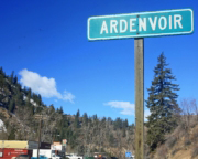
Ardenvoir Right on a lake of the same name, Chelan is the place to go for food, gas and lodging in Northern Chelan County.
Chumstick Mountain Summit A few extra minutes off the main route delivers riders to one of the best locations on the WABDR. After making the ascent from Cashmere, turn off the Entiat Ridge Road (NF-5200) and go up a short side road to reach one of the journey’s top summits. The 360-degree views possible from Chumstick Mountain summit are hard to beat. This mountain viewpoint is a popular spot for adventure riders and Jeeps to make a short stop, especially when low clouds aren’t blocking the views. Be sure to spend at least a few extra moments taking in the rolling mountainous terrain before getting back on the route and continuing with the backcountry expedition through Washington state.
Sugarloaf Lookout Tower Take a step back in time as the journey climbs up to one of the longer side trip options on the route. Follow the gravel road to the top, then park and make the short walk to the rugged summit of Sugarloaf Lookout Tower. If time allows, the lookout is worth the extra ride. Visitors are treated to some incredible views from this rustic high point. Originally established as a lookout for forest fires in the early 1900s, it now sits on the National Historic Lookout Register. A popular location for visitors, the old tower is still staffed during the summer months.
Ardenvoir – Food & Gas It may not be nearly as large as some of the other stops along the way, but tiny Ardenvoir serves just as important of a role for riders traveling the WABDR. The small town’s single storefront is a gas station, café and general store all wrapped into one. The stop marks an essential one for visitors passing northward through the region. Be sure to stop long enough to grab a quick lunch, plus some snacks and supplies for the long road ahead. When it’s time to head out take the time to top off your gas tank on the way out of town. Please say hi to the nice folks there who appreciate our outdoor pursuits.
Steliko Lookout Tower Take a few extra minutes for a short side trip just beyond Ardenvoir. Steliko Lookout Tower is a worthy location for a lookout tower sitting directly above the small town. Although some choose to hike up to the lookout, there’s also a steep rugged road leading directly to the top of the summit. Keep in mind road conditions can vary. The small mountain is more popular for its history and its viewing platform than its height. For those lucky enough to make it to the top, check out some of the best views to the north, including Forest Mountain, Baldy Mountain and Tyee Mountain.
Slide Ridge Views Take in views of Lake Chelan and beyond as you traverse Slide Ridge on the Washington BDR. Make the quick stop to admire the scenery hen traveling this part of the route. At over 6000 feet in places you’ll be passing right by the summits of Stormy Mountain and Baldy Mountain while visiting the ridge. You’ll probably see cars at the Windy Saddle Trailhead where hikers set out for the short hike to the top of Stormy. Keep in mind, though, Slide Ridge sometimes lives up to its namesake with occasional mudslides that make getting here just part of the adventure.
The Jungle (Forest Road 233) One of the most difficult sections of the route, The Jungle is easily the road less traveled. A turn off the beaten trail, Forest Road 233 is quite literally an old abandoned road that’s barely open. It may take some work to travel through this area, including perhaps a saw to chop down branches before even heading down the old road. If big adventure is a part of the plan, though, be sure to at least try to give it a go. If the road’s too overgrown, there’s always the option of the newer main road as a worthy alternative.
Twenty-Five Mile Creek State Park & Campground For fun and adventure on Lake Chelan, head to Twenty-Five Mile Creek State Park & Campground. This stop’s a great place to take a dip or pitch a tent for the night in the campground. Share the space with boaters at the marina or stock up on necessities at the small park store. The location’s also popular for fishing, bird watching, mountain biking and even scuba diving. It’s additionally a jumping off point for hikes into the North Cascades. A Discover Pass is the ticket into the park, but keep in mind the campground closes during cooler months of the year.
Lake Chelan State Park Extremely popular during the summer months, Lake Chelan State Park is easily one of the most visited parks along the route. Join boaters, windsurfers and anglers at the lake, hang out on the long sandy beach or grab a raft and float in the calm lagoon. The park is also the place to rent stand-up paddleboards, do some wildlife viewing or get in a game of volleyball on the side. For a longer stay the park offers plenty of campsites. Be sure to stock up on food, snacks and more before leaving the park and heading to the next stop on the WABDR.
Lake Chelan Lakeside Park No doubt by this part of the trip it’s time to wind down and relax. Lake Chelan Lakeside Park is the perfect day trip for taking a slow dip in the cool lake water or even taking a plunge from one of the docks. The year-round park has shade trees for dozing off, plenty of fun in the sun, and boat rentals to get out on the water. The site also features sand volleyball, pick-up basketball, a putting course and more. For a quick stop the park delivers the ease of picnic shelters, a seasonal snack bar and a welcoming setting.
Chelan – Food, Gas, Lodging Right on a lake of the same name, Chelan is the place to go for food, gas and lodging in Northern Chelan County. This full-service town is extremely popular in the summer with visitors, so take some time to check out its parks, fresh farmer’s market, live music and more. With plenty of local restaurants to choose from, grab a spot beside the water, a spot to camp for the night, or book an overnight stay in one of the town’s many inns or resorts. Before leaving town take a stroll through Downtown Chelan to enjoy its charming small-town vibe.
CHELAN TO CONCONULLY – 103 MILES
The route ascends north from Lake Chelan past the Echo Valley Ski Area toward Cooper Mountain, a 5,867 foot summit with stunning views. The route then passes Black Canyon Creek and skirts Fox Peak before descending the Gold Creek Valley to the Methow River and Hwy 153. Heading north on Hwy 153 riders used to be able to fuel up in the one-store town and gas pump in Carlton before heading east on Benson Creek Road.
The path heads up past Thrapp Mountain and Woody Mountain before dropping down into the valley to Hwy 20. After a short highway section riders are back on dirt heading north on scenic Loup Loup Canyon Road in the Loup Loup State Forest. The steep Ruby Grade descends toward a site where the mining town of Ruby once existed. A sign at the site describes a bustling mining community that was the center of commerce in the Okanogan area until the market for silver collapsed in 1892. Gravel and paved roads take riders to the one-store town and gas pump in Conconully. In addition to the store, there are lakes and a state park in the area.
Echo Valley Resort & Cabins Just outside of town, on your ride you will pass right by the Eco Valley Ski Area and summer time resort. A popular spot during the winter months where locals hit the slopes for some fun in the snow (skiing and snow tubing), it’s much quieter in the summer months.
- Address: 1800 Cooper Gulch Rd, Manson, WA 98831
- Phone: (509) 687-8467
Carlton Just outside of town, on your ride you will pass right by the Eco Valley Ski Area and summer time resort. A popular spot during the winter months where locals hit the slopes for some fun in the snow (skiing and snow tubing), it’s much quieter in the summer months.
Twisp From food and shopping to arts and adventure, riders can make time for a side trip to the town of Twisp. This full-service town offers everything riders need on the WABDR.
Conconully Load up on food, fuel and supplies at the General Store or grab a full meal at one of the local restaurants. The town also has several places to get some rest for the night or set up a campsite right on the shores of Conconully Reservoir.
Winthrop Step back in time to the Wild West with a side trip to Winthrop. The small town is a favorite of tourists thanks to its old west inspired buildings and easy outdoor recreation. Grab a bite to eat or play some pool at Washington’s oldest legal saloon or check out any one of the other food and lodging options in town.
Cooper Mountain Summit For some of the most stunning views overlooking the North Cascades, Cooper Mountain Summit is easily one of the most important stops along the route. Take some extra time for a short ride out to the summit to enjoy the scenery from this mountain viewpoint. The highest point of a long ridge north of Lake Chelan, a clear day offers up panoramic mountain views from the top of the summit. It’s also a good spot to see native wildlife, take some pictures or simply rest high above it all. For a stop that’s hard to forget, pull off the main track to this scenic mountainous stop on the WABDR.
Carlton – Food, Gas, Camping Tiny Carlton marks one of the last locations for riders to make a brief stop on this part of the route. This small community has long served riders with a one-stop shop for non-ethanol fuel and a general store to stock up on any last-minute needs and supplies on the road. As the Carlton General Store is currently closed and up for sale, for now riders can simply continue the ten short miles up Highway 153 to the full-service town of Twisp. Here visitors are sure to find a longer stop in store, plus everything else needed to continue on the remainder of the WABDR.
Twisp – Food, Gas, Lodging From food and shopping to arts and adventure, riders can make time for a side trip to the town of Twisp. This full-service town offers everything riders need on the WABDR. If you visit, stroll through the charming downtown and sample some of the bakeries, cafes and brewpubs of this area. It’s also the place to stock up on groceries and supplies, fuel up, relax in the park or browse through local art galleries. Book a stay in one of the town’s motels or B&Bs, or head to a nearby campground to get some needed rest on this part of the journey.
Winthrop – Food, Gas, Lodging Step back in time to the Wild West with a side trip to Winthrop. The small town is a favorite of tourists thanks to its old west inspired buildings and easy outdoor recreation. Bordered by North Cascades National Park to the west, the town is a popular spot for cross-country skiing, river rafting and more. Grab a bite to eat or play some pool at Washington’s oldest legal saloon or check out any one of the other food and lodging options in town. From authentic Cowboy Dinners to an Old West museum, there’s plenty to see and explore in this tiny town.
Leader Lake A short side trip off the main route, make time to head to Leader Lake and Campground. This popular fishing hole is also a good spot to cool off in the water after a long ride during the warm summer days. The year-round spot has room to camp on both sides of the lake but be sure to take along a Discover Pass to stay for the night. It’s best known, though, for its fishing, especially for rainbow trout in the summer and winter. It’s not uncommon, however, to spot people fishing and visiting during all months of the year.
China Wall of Loup Loup It may take some time to find, but a trip to the China Wall of Loup Loup is a must for its history and its uniqueness. These tall granite stone walls were actually part of Loup Loup, a thriving mining town in the late 1800s. Now deserted, the old town once served as a bustling area with hotels, saloons and more. The old wall, though, is more of a mystery. Found along the side of Ruby Hill, the ten walls measure up to 80 feet long and 27-feet tall. While much of the town’s history is no longer around, the old wall still stands as a puzzling reminder of its past.
Arlington Mine Site Just a short trip for riders off the WABDR, the old Arlington Mine site takes visitors on another trip through history. Originally dating back to the late 1800s, thousands of tons of ore have been mined from the site. It’s a bit overgrown now so keep an eye out for evidence of old mining operations on the hill above Loup Loup Canyon. Although it hasn’t been in operation for decades, it’s still a cool spot for visitors to take some pictures, or just walk around and do some exploring. It’s all simply a short side trip off the main route.
CONCONULLY TO CANADA – 66.3 MILES
The route heads north from Conconully and pavement eventually turns to dirt again as riders reach Salmon Meadows in the Okanogan National Forest. Riders soon enjoy views as they climb up and over Lone Frank Pass (the highest point on the WABDR). After a short distance the route enters Loomis State Forest and heads up the ominously named “Skull and Crossbones Road” where an old homestead cabin and corral can be seen before heading down to North Fork Toats Coulee Creek. There is a geocache near the viewpoint above Cold Springs Campground up Ninemile Creek Road (see map for coordinates). The route then winds down steep switchbacks into a spectacular valley just south of Palmer Lake in the Sinlahekin Valley. With the dirt and gravel behind you, pavement leads you north past Palmer Lake through the former town of Nighthawk along the Similkameen River to the Nighthawk border crossing from the US into Canada.
Salmon Meadows Camp Nine miles north from the town of Conconully, join fellow campers who are venturing deeper into the North Cascades at Salmon Meadows Camp. This small campground sits on the east side of Thirtymile Ridge, with plenty of room for tent camping with a view.
North Fork Ninemile Campground Located near a scenic forest stream, North Fork Nine Mile Campground is a secluded campground up Toats Coulee Road.
Cold Springs Camp and Viewpoint Turn just a few miles off the main route to reach Cold Springs Camp and viewpoint. A fun place for visitors to ride to, it’s possible to take in some views from this hilltop clearing of Chopaka Mountain and the Pasayten Wilderness.
Chopaka Lake Campground Less than a mile off the route, make the short side trip to camping, fishing and more at Chopaka Lake Camp. This popular lakeside campground is a favorite for fly fishing.
Loomis If needed, Loomis one of the last towns near the northern end of the WABDR to make a stop to stock up on food, supplies and fuel to complete the journey. A slight side trip to this tiny town provides riders with access to the town’s local store, Loomis Kwik Stop.
Funk Mountain Lookout A small side trip off the WABDR, it’s possible to ride almost right up to Funk Mountain Lookout. It only takes minutes to reach the old lookout tower from the access gate but it’s a steep climb to the top! Take in panoramic views of the treetops, nearby peaks and the rolling terrain. The old fire lookout tower is also a great place to see the original “crow’s nest” platform high up in a nearby tree. Bring a Northwest Forest Pass to park. There’s also the option of backcountry camping or camping at one of the official campgrounds not far from the site.
Salmon Meadows Camp Nine miles north from the town of Conconully, join fellow campers who are venturing deeper into the North Cascades at Salmon Meadows Camp. This small campground sits on the east side of Thirtymile Ridge, with plenty of room for tent camping with a view. The $8 camping fee includes a picnic table and fire ring plus limited camp facilities. Spend the daylight hours hiking or riding through the forest near the camp, or just lounge in the meadows soaking up the sun. The campground is also a great place for wildlife watching and for some nearby snow sports during the cooler months of the year.
Lone Frank Pass 6712′ As the route gets closer and closer to the Canadian border, climb up and over the highest point on the WABDR. Lone Frank Pass crests a ridge at about 6,700 feet, so take it slow enough to soak in the surrounding views before they’re gone. Pull off for a few minutes for pictures or just to admire the peaceful serenity of this spot high above the rest. Years ago, a deadly forest fire ravaged Thirtymile Ridge and the pine trees haven’t returned creating distant views from many spots near the pass. When it’s time to go, hit the road again for a ride through Loomis State Forest and on to the next adventure as the road trip continues along the most northern part of the WABDR.
Skull & Crossbones Corral and Cabin One of the most unique, and ominously named places to make a stop along the route sits in a remote section of Loomis State Forest. At the top of Skull and Crossbones Ridge riders are treated to the unusual site of the remnants of an old log cabin. Ride right up to the Skull & Crossbones corral and the old cabin to get a closer look at the primitive site. It’s likely not a long stop but it is a fun spot to get a closer look and perhaps snap a few pictures before continuing on with the route to the Canadian border.
Cold Springs Camp and Viewpoint Turn just a few miles off the main route to reach Cold Springs Camp and viewpoint. A fun place for visitors to ride to, it’s possible to take in some views from this hilltop clearing of Chopaka Mountain and the Pasayten Wilderness. It also happens to be where the original WABDR geocache was stashed (it no longer remains). Surrounded by more than 50 miles of hiking trails, the campground is a great place to do some exploring during a slightly longer stop, or to just stop, relax and eat some lunch at one of the picnic tables surrounded by the natural beauty of preserved land.
Chopaka Lake Campground Less than a mile off the route, make the short side trip to camping, fishing and more at Chopaka Lake Camp. This popular lakeside campground is a favorite for fly fishing. It’s also a good spot to cool off during the warmer months of the year, but don’t expect much in the way of facilities. Take a Discover Pass to park and camp for the night at one of the primitive camping sites, then enjoy this setting in a deep valley surrounded by steep mountains. Be sure to keep an eye out for wildlife in this area, including mountain goats, bighorn sheep, deer, and possibly even bears.
Loomis – Food & Gas If needed, Loomis one of the last towns near the northern end of the WABDR to make a stop to stock up on food, supplies and fuel to complete the journey. A slight side trip to this tiny town provides riders with access to the town’s local store, Loomis Kwik Stop. Here riders can fuel up their bikes and grab other items to help make the final part of the journey. If the town does not have what’s needed, try the towns of Tonasket or Oroville.
Nighthawk Ghost Town Next up on the route is the tiny ghost town of Nighthawk. Once a booming mining town the old town is now little more than a few residents and some old deserted buildings. This privately-owned former town sits on the Similkameen River, and visitors drive right by it on Loomis-Oroville Road. Although it’s worth a second glance riders are advised not to disturb the current residents. Now a shell of its former self, the last mine in the area closed more than a half century ago. There aren’t any services for visitors these days, but it’s still an interesting place to ride by on the way to the border.
Canada-Washington Border The official northern end of the WABDR delivers riders right to the Chopaka US-Canadian Border crossing. This crossing connects up Loomis, Washington with the sister towns of Cawston and Keremeos, British Columbia on the other side. Don’t expect to see many other vehicles in this area, as it’s the least used Canadian border crossing in the State of Washington. That’s likely because it’s also near one of the most remote locations. Be sure to take in the surroundings but don’t try taking any photographs as photos are prohibited near the border crossing.
PLAN YOUR ADVENTURE
Wabdr packing list.
This packing list serves as an example and is not intended to be a complete list for your backcountry riding needs. Feel free to customize this list to work for you.
- Map holder / map case
- Phone charger
- Plug adapter: auto to BMW plug
- Riding socks (2)
- Zip pants/shorts
- Short sleeve (base layer shirt)
- Flip flops/sandals
- Riding jersey / long-sleeve (base layer shirt)
- Fleece jacket
- Wool beanie
- Clip-style master link
- Spare inner-tubes
- Gloves (2 sets)
- Protective gear (pressure suit, Leatt brace, knee braces)
- Balaclava or neck gaitor
- Water bladder or bottle
- Hydration pack
- Toothbrush & Floss
- Towel (MSR Pack Towel)
- Toilet paper
- Pain reliever
- Allergy meds
- Sun Glasses
- Passport if going into Canada
- Money (credit cards & cash)
- Sleeping bag
- Dry bags (2) for tent, sleeping pad & sleeping bag
- Water storage (Dromedary Bag)
- Folding hand saw
- Water filter
- Eating utensils
- Lighter / waterproof matches
- Pots & pans
- Coffee brewing device
- Headlamp (2)
- Kitchen set & spices
- Stove fuel bottle
- Folding camp chair
- Forest & National Parks maps
- WABDR Butler Map
- Tool roll / tool set
- Tire levers
- Tire patch kit
- Leatherman tool
- Swiss Army knife
- Large inflation CO2 (for tubeless tires)
- First Aid kit
- Energy bars
- Other ingredients based on meal plan
WABDR MOTORCYCLE DEALERSHIPS
Cascade Moto
Tigard, or 97223.
Cascade Moto is Portland, Oregon's ADV headquarters. Both our Triumph and BMW showrooms stock new and used adventure bikes, parts and apparel, ADV accessories, and more. Both of our locations are near the start of the WABDR and ready to help you make your next ride the best yet. Come stop by our shop and tell us about your next adventure!
CENTRAL POWERSPORTS
Ellensburg, wa.
Central Powersports is a family-owned and operated business and you feel it the minute you walk through the door. The Micallef Family lives and plays in Ellensburg and have spent their lives finding adventure around the northwest!
The entire team at Central Powersports bring their “play hard” experience to help our customers find their next adventure; that could be dirt bikes, mud-flinging fun, snowmobiling, or riding on the open road – Our team has the working knowledge to help you find your fun all year long!
WENATCHEE POWERSPORTS
Wenatchee, wa, frequently asked questions.
Below are answers to some Frequently Asked Questions about the Washington Backcountry Discovery Route.
What is the WABDR?
The Washington Backcountry Discovery Route (WABDR) is a mostly off-road route from Oregon, USA to British Columbia, Canada. The South to North route winds through the Cascade Mountains and some arid landscapes in the foothills of Eastern Washington. The roads include dirt, gravel, and pavement surfaces and may include rocks, ruts, sand, mud and snow depending on time of year and conditions. The route can be completed in 4-6 days depending on pace, and is also accessible by four-wheel drive vehicles, as the entire route is at least double-track.
What time of year can I do the WABDR?
The WABDR is best from July-October depending on snowpack and weather.
How long does it take to run the WABDR?
Most people average 150 miles a day on a backcountry motorcycle trip. Plan on doing this route in 4-6 days depending on how fast you want to travel and how early you want to roll out of camp.
How do I get information on current road conditions?
We do our best to post the most up-to-date information on our Route Updates Page . We depend on the BDR community to inform us about route and road conditions, so if you encounter any road closures or severe conditions that are worth reporting, please contact us with the information.
There is also a dedicated WABDR Facebook Group Page . We recommend that you join the group prior to your trip to read trip reports and comments from other riders about their experience on the route.
Don’t forget to use our Interactive Map to get route conditions in real time. Read this Article to a quick tutorial on how to use the Interactive Map.
Where can I find the GPS tracks for the WABDR?
Why do I need paper maps when I have GPS tracks?
Always bring a complete set of maps for the area you plan to ride. They have good information about roads, water sources, and are an indispensible resource when the GPS doesn’t work, or is giving questionable advice. Unplanned events can occur and having paper/synthetic maps of the area can be a life saver. National Forest maps are available at www.naturenw.org and local Ranger Stations. WABDR Butler Motorcycle Maps are available at Touratech-USA and Butler Maps .
How far between gas stops?
The longest gap between gas stations is approximately 122 miles from Packwood to Ellensburg, unless you stop for gas in Nile Valley on Hwy 410. The next longest section is 120 miles between Stevenson and Packwood. Premium fuel is available in Stevenson, Packwood, Ellensburg, Cashmere, Leavenworth, Chelan, Twisp, Omak and Oroville. Low octane gas is available in Carlton, Nile, Ardenvoir and Conconully. The elevation chart on the WABDR Butler Map includes all the mileage details and fuel locations.
Can I have a camp fire?
Check with local Ranger Stations to determine if campfires are allowed before you build one. Forest fires are a threat during parts of the year and the rules that manage this risk must be followed. Be sure to fully extinguish fires so they are DEAD-OUT. Use water to ensure a fire is fully extinguished and the ground is left cool and wet.
Where do I camp?
There are many campgrounds and suitable dry camping locations along the route. The Butler Motorcycle Map for the WABDR has a tent icon showing campgrounds on the route and many near the route. The WABDR Butler Map is available through Touratech-USA and Butler Maps . In addition, the Wenatchee , Okanogan , and Gifford Pinchot National forest maps show a tent icon for all campgrounds. These maps are available at www.naturenw.org and local Ranger Stations. Make sure to leave all camp locations clean and safe for the next user.
Do I have to camp?
No, you can complete the WABDR using hotels and restaurants fairly easily. Hotels, restaurants and grocery stores are available in Stevenson, Packwood, Ellensburg, Cashmere, Leavenworth, Chelan, Twisp, Omak and Oroville. Limited accommodations are also available in Conconully.
Is there water on the route?
You can find potable water in the towns along the way, or use a filtration system and source the water from creeks and springs along the route. The National Forest maps are a good resource for finding suitable creeks and springs. Choosing a camp location close to a water source is a good idea. It is strongly recommended to have a water filtration solution with you at all times in the backcountry. A filtration solution will allow you to carry less weight on the bike since you don’t have to haul your water. It’s also more flexible if you run into delays or have a mechanical issue along the way. Here is a video on water filtration filmed in the Oregon Backcountry: http://youtu.be/vqOFZAoZdTU
What GPS should I use?
Any GPS unit capable of displaying 10 track logs with a minimum of 500 points each is suitable for use on the WABDR. Garmin models that work best for this application are: Zumo 665/660, GPSMap 60, 62, 76, 78 and 276. Other GPS manufacturers may have units that will work. Check the technical specs to determine suitability.
Do I need a Discovery Pass?
A discover pass is required on street legal vehicles when using state recreation lands. For more information visit www.discoverpass.wa.gov/faq
What is the ideal bike to use?
Any bike that has a license plate, can run knobby tires and is set-up to carry the gear you plan to bring, and has the fuel range to make the distance between gas stops. Most adventure or dual sport motorcycles will be suitable for the trip.
How difficult is the route?
The WABDR route is designed to be ridden on adventure and dual-sport motorcycles, as well as driven in 4×4 vehicles. There are no single-track style trails on this route. Many of the roads are in remote areas and reach high elevation areas where road maintenance is minimal or non-existent. You can expect to cover sections of road with deep ruts, loose rocks, sand and other challenges. There are also sections that have steep grades combined with rough surfaces. You may also encounter sections that have trees or branches over the road. Some of the roads are overgrown with foliage, but are passable by both motorcycle and 4×4 vehicles. There are alternate “easier” routes around a few of the most challenging sections. Depending on time of year and weather, there may be a few small shallow water crossings, but none worth worrying about. Certainly nothing like the Malheur River on the OBDR (Oregon Backcountry Discovery Route)
Are there any gates on the route?
Yes, there are several gates on the route. Please make sure to close all gates that you pass through.
What tires should I use for the WABDR?
DOT approved knobby tires are strongly recommended. Our team members used either Continental TKC 80 or Dunlop 606 tires when we rode the route.
What is the highest elevation on the WABDR?
The highest elevations are reached in section 6 where Lone Frank Pass reaches nearly 7,000 feet. The route starts at nearly sea level and brings riders up to 5,000 to 6,000 multiple times on each section.
Is there cell phone coverage on the route?
Much of this route is remote and out of reach for cell phone towers. There will be long sections with no coverage. Your best bet to talk or text is in the towns or on top of mountains. You will be surprised where you get coverage and where you don’t. A satellite communication device is a good idea in the backcountry.
When is the border crossing at Nighthawk open?
The Nighthawk border crossing is typically open 9am – 5pm seven days a week. The nearby border crossing at Osoyoos just north of Oroville is open 24 hours a day. The US Border Office phone number is (509) 476-2125. Remember to bring your passport if you plan to cross into Canada.
Can I ship my bike up to the NW?
South Sound BMW provides a safe and convenient location to have your bike shipped to the Seattle/Tacoma area. They will allow you to use their shipping dock and warehouse to facilitate the shipping of your motorcycle. In most cases there is no charge for the receiving service. Email [email protected] or call (800) 303-1838 for more information. Additionally, Motorcycle Shippers provides shipping services within the US.
What medical supplies should I carry on a BDR trip?
This advice comes from Rob Watt, BDR Board and Expeditions Member, and Wilderness EMT.
We carry items for wound management, breaks, basic meds and dental. You can buy a good first aid kit at one of the outdoor stores online or Touratech-USA. Get one that is an Extended Day Backpacker or 3-4 person kit. These kits usually have the basics for a motorcycle trip.
They usually don’t have a SAM splint, so pick one of those up along with a couple ace bandages. One other thing that we do for every multi-day trip, is to gather important information about each rider: allergies, medications, medical issues, emergency contacts, etc.
Then we put that on a master sheet for each person, so if something does happen we have that information handy incase that person can’t speak. Another good practice is to do a little research of where medical facilities are along your planned route. Is there a “flight for life” in the area? Where are the hospitals, Medical clinics, etc?
Here is a list of some items that you should have in your medical kit:
- Bandages: Assorted sizes for small cuts, blisters, etc.
- 4-inch closure strips or butterfly closures: For closing large wounds. 4-inch strips are more effective than butterfly.
- 4 inch by 4 inch sterile dressing pads (5 to 10): To apply pressure to a wound and stop bleeding
- Non-adherent sterile dressing (2 inch by 2 inch): Use these or Second Skin to cover blisters, burns or lacerations.
- Gauze roll: Holds dressing in place.
- Small roll of 1-inch adhesive tape: Holds dressings in place.
- Multi-use tool or knife: Should include knife, scissors. A scalpel and blade are also useful for first aid.
- Forceps or tweezers: For removing splinters, ticks, and removing debris from wounds.
- Scissors: Trauma scissors, which have a blunt end to protect the patient, can be used for cutting away clothing from injury, cutting medical tape, etc.
- Thermometer: Digital is generally more accurate, but batteries do wear out.
- Malleable splint: Lightweight foam-covered aluminum, such as a SAM splint.
- Irrigation syringe (35 cc): Used to flush and clean wounds.
- Suction syringe (65 cc): Used to clear mouth of fluids when giving CPR.
- Safety pins: Can help remove splinters, fasten arm sling, or make a whole in a plastic bag for improvised wound irrigation.
- Cotton-tip swabs: For removing foreign objects from eye, or applying antibiotic ointment.
- Resealable plastic bags: Many uses, including icing a swollen joint or creating wound irrigation device.
- ACE, Coban, or other rubberized bandage: Can be used as outer wrap on splints, wound dressings or support for joint injuries. Be careful not to wrap too tightly.
- Antiseptic towlettes: For cleaning small wounds.
- Cleansing pads with lidocaine: For cleaning. Includes a topical anesthetic for abrasions, stings, etc.
- Topical antibiotic ointment: For application to wounds. Simple Vaseline can also be used in dressing a wound.
- Moleskin: Prevents blisters. Cut and apply a section to your foot as soon as you discover a “hot spot.” Duct tape also works for this purpose.
- Povidone Iodine USP 10 percent, 1 oz.: For preventing infection. Bottled PVD iodine 10 percent solution should be diluted to a ratio of 1 percent or less for flushing wounds.
- Aloe vera gel: Found in packets or small bottles for relief of minor burns.
- Pain relievers, including aspirin and Ibuprofen: Provides relief for minor aches and pains, reduces fever, helps reduce inflammation of sprains and other injuries.
- Antihistamines: For relief of pollen allergies, or to reduce reaction to bites and stings.
- Immodium 2 mg capsules or tablets: For relief of diarrhea from intestinal infections.
- Pepto Bismol or antiacid tablets: For relief from general diarrhea, abdominal upset.
- After Bite or hydrocortisone cream USP 1 percent: Relieves skin irritation from bites, poison oak, stings, or allergic reactions.
- Latex or nitrile gloves: Protects against blood-borne diseases and infection.
- CPR microshield mask: A compact flexible barrier with a one-way valve for rescue breathing, which protects user from blood, vomit or saliva.
- Oral rehydration salts: Packet of electrolyte salts and glucose for treatment of dehydration, heat exhaustion, or loss of fluids from vomiting or diarrhea.
- Space bag/blanket: Lightweight emergency shelter. For treating hypothermia victims.
- Paper and pencil: For recording medical data such as body temperature, pulse, time and date of symptoms, injuries, medicines administered, etc. Most repackaged kits include accident report forms.
- Wilderness First Aid booklet: Many prepackaged first aid kits contain one. An excellent pocket guide is the Wilderness Medical Handbook
Which BDR is the easiest? Which one would you recommend for a rider that hasn’t done a long trip on dirt before. I have just taken an intro level training course and I ride a 1200GSA?
We get this question all the time. Here are some key things to consider as you put together your plan.
All of the BDR routes include intermediate to advanced terrain. If a person is on a large bike twin-cylinder bike like an R1200GS Adventure or Yamaha Super Tenere, the routes can be very difficult. If a person’s skills are not advanced level, they may consider taking a smaller bike or choosing the easier options when possible. A BDR is something a person should build up to and it shouldn’t be their first overnight trip on their ADV bike.
Although, WA and CO are less difficult than UT and AZ, they all contain difficult sections. We suggest looking at the Butler Map and take the optional easier routes to avoid the difficult sections. Even taking this approach there may be difficult stretches depending on changes in road conditions, weather, construction and the unknown. This is part of what makes it an adventure. Regardless of its description on the map or in the film, no section of a BDR should be underestimated.
Do some shorter overnight trips as practice and ride increasingly difficult terrain to build up your skills and confidence. Also remember that riding with a fully-loaded bike should be practiced prior to tackling a BDR. Lastly, always ride with a group so that you have a team to help overcome any obstacles whether it’s terrain, mechanicals, navigation, medical emergency, etc…
In summary, take baby steps and work up to doing a BDR. Don’t make it your first adventure motorcycle outing on a full-sized twin-cyclinder bike.
Rating the Routes by Difficulty
We often get requests to provide the difficulty ratings of the BDR. We do not officially rate roads or routes because the difficulty can change from day to day depending on weather, changes in road conditions, and road damage caused by a variety of forces including wind, storms, flooding, snow, logging, forest fires and more.
The difficulty experienced by an individual also depends on their off-road skills, level of fitness, stamina, bike size and amount of weight carried on the bike. For these reasons we can’t provide a rating system like a ski resort or OHV park.
We can help you a bit by ranking the existing Backcountry Discovery Routes from most difficult to least difficult. Here is the list: CABDR-South, NEBDR, AZBDR, ORBDR, WYBDR, UTBDR, COBDR, NVBDR, WABDR, NMBDR, CABDR-North, IDBDR, MABDR.
So CABDR-South is the most difficult especially if you ride the expert sections and MABDR is the easiest in general terms. Although MABDR is the easiest there are still a few challenging rocky sections and the several water crossings that can get very difficult if the water is high.
Be sure to also review the FAQ’s for each route and our General FAQs prior to embarking on your trip.
Subscribe to our mailing list:
- Name This field is for validation purposes and should be left unchanged.
General Questions:
Phone: (206) 383-6233 Email: [email protected]
Route Questions:
Email: [email protected]

This site uses cookies. By continuing to browse the site, you are agreeing to our use of cookies.
Cookie and Privacy Settings
We may request cookies to be set on your device. We use cookies to let us know when you visit our websites, how you interact with us, to enrich your user experience, and to customize your relationship with our website.
Click on the different category headings to find out more. You can also change some of your preferences. Note that blocking some types of cookies may impact your experience on our websites and the services we are able to offer.
These cookies are strictly necessary to provide you with services available through our website and to use some of its features.
Because these cookies are strictly necessary to deliver the website, refusing them will have impact how our site functions. You always can block or delete cookies by changing your browser settings and force blocking all cookies on this website. But this will always prompt you to accept/refuse cookies when revisiting our site.
We fully respect if you want to refuse cookies but to avoid asking you again and again kindly allow us to store a cookie for that. You are free to opt out any time or opt in for other cookies to get a better experience. If you refuse cookies we will remove all set cookies in our domain.
We provide you with a list of stored cookies on your computer in our domain so you can check what we stored. Due to security reasons we are not able to show or modify cookies from other domains. You can check these in your browser security settings.
These cookies collect information that is used either in aggregate form to help us understand how our website is being used or how effective our marketing campaigns are, or to help us customize our website and application for you in order to enhance your experience.
If you do not want that we track your visit to our site you can disable tracking in your browser here:
We also use different external services like Google Webfonts, Google Maps, and external Video providers. Since these providers may collect personal data like your IP address we allow you to block them here. Please be aware that this might heavily reduce the functionality and appearance of our site. Changes will take effect once you reload the page.
Google Webfont Settings:
Google Map Settings:
Google reCaptcha Settings:
Vimeo and Youtube video embeds:
The following cookies are also needed - You can choose if you want to allow them:

Let us plan your trip for you
Roadtrippers Autopilot™ creates your itinerary based on what we’ve learned from over 38 million trips. You’re never more than a few clicks away from your next great adventure.
- Auto Travel

Let Autopilot take the wheel planning your next road trip, scenic drive, RV journey and everything in between. Then enjoy the ride while uncovering hidden gems along the way.
Get real-time traffic updates and access to wildfire smoke maps to stay informed and connected throughout your journey.
Collaborate
Share your itinerary with your copilots so they can help with the finishing touches.
Let Roadtrippers be your guide, navigating the twists and turns as you roam the open roads with confidence and ease.

Exclusive Access To Autopilot
Let us do the planning for you! Enter in a few key details and we’ll craft a custom tailored trip just for you.

Choose the right plan for you—and try it free for 7 days
Premium planning.

RV-Friendly Tools

Overnight RV Parking

Start free for 7 days
Then $35.99 (that's only $2.99/month), then $49.99 (that's only $4.17/month), then $59.99 (that's only $4.99/month).
† RV-Friendly routing features (including routing warnings for vehicle hazards and propane restrictions) are available in the U.S. only.
Free 7-day trial
Test drive the best features of Roadtrippers Premium for free! Eligible users will get exclusive access to all the tools needed to plan the perfect road trip.
Create a Roadtrippers account to start your 7-day free trial.
Already have a Roadtrippers account?
We need your email address
Before we can sign you up for Roadtrippers, we need your email address. Click the button below to go to your profile.
Plan your next adventure with a Roadtrippers Premium account
Due after 7-day free trial
Thank you for signing up for a Roadtrippers Subscription
Get started planning your next trip now!

Good news...you already have Roadtrippers!
Thanks for being one of our most dedicated users.
- Sign up Log in Sign out
- Log in Sign out
Plan your journey, find amazing places, and take fascinating detours with our app.
If you used to sign in with Roadpass, you should now use the same username and password to log in directly with Roadtrippers above.
We couldn't find an existing Roadtrippers account using that service. Please try signing in with another option.
We need your email address to send you trip itineraries and other updates.
How do you want to plan your trip?
With just a few questions, our newest Premium feature, Autopilot, will plan your next adventure.

America's Best Off-Road Trips
10 of the wildest and most scenic drives in the country to take entirely on dirt and gravel

Hitting the open road is a distinctly American pastime, and no season calls for it more than summer. But might we suggest a little twist on the idea? We call it the off-road trip, for the folks with four-wheel-drive and a taste for adventure—not to mention dust. So, with the hope to inspire you to break away from the pavement, we've compiled some of the greatest trips you can make, all (or mostly) on dirt and gravel. Here they are, in no particular order.
Mojave Road, Arizona & California

There are few better ways to spend two to three days behind the wheel of a 4x4 than traversing the Mojave Road. Running from Bullhead City, Arizona to Newberry Springs, California, this 140-mile trail is chock full of historical landmarks…and snakes. Don't forget the snakes. Originally blazed by Native Americans, the road has been travelled by Spanish explorers, European colonizers, and the U.S. Army over the last several hundred years. And there's good reason; it's home to some of the region's finest landmarks, including the Colorado River, Joshua Tree Forest, Rock Spring, Soda Lake, and Government Monument where travelers piled up rocks they carried across the dried Soda Lake bed. Word to the wise: Pack lots of water. There's only one watering hole along the way.
Washington Backcountry Discovery Route, Washington State
If you were worring that this list may be too technical, here's some relief: The Washington Backcountry Discovery Route is a long but easy 4x4 trail. Though it lacks guardrails and boasts some seriously steep grades, the five- to six-day WBDR can be driven by weekend outdoorsmen or those who require some creature comforts, as both campsites and hotels are available on the route. Unlike many of the trails of this list, the WBDR offers truly diverse terrain, ranging from the lush temperate rainforest of the Cascade Mountains to the arid high desert of Eastern Washington.
Alpine Loop Trail, Colorado
To get to the Alpine Loop Trail, you'll have to head five hours southwest of Denver until you reach Lake City…then hang a right. Okay, it's a bit trickier than that, but not much. Traversing the San Juan Mountains, this 63-mile trail crosses two 12,000-foot passes, past seven ghost towns, and right by more more breath-taking vistas than you can count. Most of the trail is suitable for 2WD vehicles; however, 4x4s with high ground clearance are recommended if you want to find the best views. And, for Californians unfamiliar with seasons, just a word of warning: portions of the Alpine Loop is closed during winter—so don't even try.
Arizona Backcountry Discovery Route, Arizona
Dalton highway, alaska.
Hope you like gravel, because the Dalton Highway – aka "The Haul Road" – presents 414 miles of it, as well as tractor-trailers, pot holes, and grizzlies, for good measure. If you decide to take this rocky route from the Yukon River to Prudhoe Bay, there are some things you'll need to consider. First, Fairbanks, the closest community to the start of the highway, is 70 miles away, so you'll need to stock up there. Experts also suggest you attempt it in a 4x4 loaded with extra fuel, food, tires, and a trunk filled with supplies. As with a lot of the trips on this list, there are no services along the way so you'll have to be self-sustaining. Also, have your headlights switched on at all times, and tune your CB radio to channel 19 – the frequency used by Dalton truckers.
Rubicon Trail, California
Due west of Lake Tahoe and 80 miles east of Sacramento lies the Rubicon Trail, a 4x4 wonderland so iconic its name was bestowed upon the stoutest of Jeep Wrangler models. Though only 22 miles long, the Rubicon cuts through the El Dorado National Forest as well as the Tahoe National Forest and boasts some extremely challenging terrain. Only specialized 4x4s should attempt the trail, and the Rubicon Trail Foundation warns drivers to expect at least a modicum of sheet metal damage. Your best bet for finishing unscathed is to outfit your rig with a three-inch lift, 33-inch tires, and some rocker guards. While you're at it, a full roll cage, fire extinguisher, and first aid kit may be worth your time, too.
Magruder Road Corridor, Idaho & Montana
"Primitive one-lane road," "steep and winding," and "snowstorms are possible at any time," are just a few of the phrases used by the U.S. Forest Service to describe the 117-mile Magruder Road Corridor—named for Lloyd Magruder who, along with his party, was murdered on the road in 1863. If you're not deterred by those warnings, you're in store for some truly fantastic off-road travel. Starting outside Elk City, Idaho, the corridor should take you around two days to traverse, averaging 12-15 mph, on the way to Darby, Montana. Along the way, you'll be witness to stunning vistas, lush valleys and rushing rivers. As for camping, there are primitive sites along the corridor.
El Camino Del Diablo, Arizona
The history of the 250-mile El Camino Del Diablo—aka "The Devil's Highway"—spans back to the 16th century, when conquistadores, settlers, missionaries, and miners used it, often on foot. Starting just southwest of Ajo, Arizona, the trail, which runs mostly along the U.S./Mexico border, is suitable for high-riding 4x4s, so leave the Subaru Outback at home. Other than a rare U.S. Border Patrol helicopter buzz-by, you'll be essentially on your own, so remember to carry water and emergency equipment. Along the way, you'll see Pinta Sand Dunes, the Pinacate Volcanic Field, the Tule Mountains, and the abandoned Fortuna Mine before reaching the trail terminus at Fortuna Foothills, Arizona.
Whipsaw Trail, British Columbia
Okay, it's not technically America (as in the U.S.), but our upstairs neighbors are still part of North America, and have at least one bucket-list 4x4 excursion: the Whipsaw Trail in British Columbia. Stretching 50 miles, the Trail can be tackled in 10-12 hours, but we recommend going slow to take in the scenery. With lakes, alpine meadows, and plenty of places to camp, the best way to do this route is at a leisurely place, spending a day-and-a-half or two to truly enjoy the Trail. With only 3,000 feet in elevation change and a few mild hill climbs, most 4x4s can handle the terrain — but to be safe, it's not a bad idea to have locking differentials, 33-inch-plus tires, and a winch.
White Rim Trail, Utah
We end our list at one of the most scenic routes: the White Rim Trail on the edge of Island in the Sky Mesa in Canyonlands National Park. Set aside two days to run the 100-mile White Rim Trail, and along the way you'll witness Utah's famous sandstone arches, as well as towers, buttes, Indian ruins, and views of the Colorado and Green rivers. Campsites along the Trail book up early and often, so plan ahead. And, as is the case with all other desert destinations, bring at least one gallon of water per person per day. It also bears mentioning that if you're feeling especially ambitious, the White Rim can be travelled by mountain bike, too.
* This article is part of The Code, an editorial partnership between Road & Track and Ford F-150 .
.css-1693l19{margin-right:0.25rem;margin-top:0.2rem;width:1.125rem;background-repeat:no-repeat;-webkit-background-position:center center;background-position:center center;}.loaded .css-1693l19{background-image:url('/_assets/design-tokens/roadandtrack/static/images/slash.svg');} Watch Next

.css-ryud0:before{margin-right:0.3125rem;width:1.125rem;height:1.125rem;content:'';display:inline-block;-webkit-background-size:1.125rem;background-size:1.125rem;background-repeat:no-repeat;-webkit-background-position:bottom;background-position:bottom;}.loaded .css-ryud0:before{background-image:url(/_assets/design-tokens/roadandtrack/static/images/slash.3b27b9a.svg);} The Code

The Evolution of Truck Design
Evel Knievel's Harley-Davidson Sportster Is Going Up for Auction
Off-Roading in Moab, Utah
What Makes a 4x4 Actually Good Off-Road
U.S. Marine Corps's New Amphibious Vehicle Is as Powerful as a Hellcat
The Ultimate Winter Tire Guide
Seven Car Apps for a Better Driving Experience
This Functional Teardrop Camper Is Made Out of Hundreds of Thousands of LEGO Bricks
Buy Evel Knievel's Motorcycle From the Wacky 1977 Movie "Viva Knievel"
Is the Amazing Ariel Nomad Better Off-Road Than a Dirt Bike?
This Tiny Bug Has a Gear in its Leg
The Trans-America Trail is Where the Adventure Begins

This guide to the Trans-America Trail is brought to you by our friends at Midland USA. Their MicroMobile two-way radios are a favorite among overlanders who depend on reliable communication on and off the trail.
Iconic trails like the Pacific Crest Trail and Appalachian Trail showcase our country’s natural beauty via hiking. Famous roads like Route 66, Pacific Coast Highway, and the Blue Ridge Parkway highlight scenic landscapes via paved highway. But what about those who want to venture off the pavement but stay on wheels?
Enter the Trans-America Trail. The TAT is a 4×4 vehicle route that stretches 5,000 miles across the lower 48 while avoiding paved roads as much as possible. The main travelers of the TAT are dual-sport motorcycle riders and overlanders who average about 200 miles per day winding through beautiful American landscapes from the Atlantic coast to the Pacific.
If you find excitement in the challenges of navigating off the beaten path, then this epic overlanding route might be the adventure you’re looking for.
Make Your Own Adventure Along the Trans-America Trail
The Trans-America Trail was founded by passionate dual-sport motorcycle rider Sam Correro, who spent 12 years working to bring the trail to fruition. Sam wanted to share his passion for off-road exploration.
So in 1984, he set off to create an off-pavement, cross-country trail of epic proportions. Sam’s route uses public roads, almost exclusively. The Trans-America Trail does not cross any private land, therefore your adventure should never be cut short by a locked gate.
Navigating the Trans-America Trail
Sam is passionate about the offroading trail and sharing that joy with others. After 30 years, he still rides the route and updates TAT navigation resources regularly to keep up with any private and public property changes that may affect navigation.
He also makes himself readily available for questions and feedback about the route. He is more than happy to assist you on planning your TAT adventure. Sam has created a route that gets off the pavement but stays close to services, food, and lodging.
His site, TransAMTrack.com , is the exclusive resource for maps, roll-charts, and GPS Tracks – travelers should avoid using other GPS files that may incorrectly lead them through private lands. According to Sam’s website, there are several other sources providing inaccurate (and illegal) trail navigation through private property. Authorities have been made aware and are issuing citations to trespassers, therefore it is vital to only use the official navigation resources provided by Sam on TransAMTrack.com.
Depending on how you choose to experience the TAT, there are several navigation resources available to you including GPS tracks, roll charts, and maps. To keep you safe and your journey fun, Sam recommends using multiple navigation tools and reliable communication like a dash-mounted MicroMobile or handheld two-way radio . Much of the route is out of cell tower range, so drivers will not be able to rely on their cell phones for navigation or communication. If you’re in a pinch you can use the offline maps and campgrounds of The Dyrt PRO to find the free public lands near you.

Sam’s maps provide a 20,000-foot view of the route. His maps include planned stops for food, drink, fuel, maintenance, and lodging options along the trail. Some of these options even include homes, ranches, and businesses that support the adventurous spirit of the TAT and extend friendly hospitality along the route.
Roll Charts
If you are going to embark on the trail with a dual-sport bike, then the TAT roll charts are for you. These rolls of paper, also called route sheets or road books, provide turn by turn instructions. Riders can easily view the next route instruction through a small viewing window of the roll chart holder mounted on the handlebars.
While GPS is not required, and riders can navigate the entire trail with roll charts, it is recommended that you also use GPS.
Want an adventure of your own? Find free camping near you
Did you know that almost all states in the US have free camping?
Although, some of it is not-so-great and can be hard to find.
There is an easier way:
- Hand-picked free campsites
- Pre-saved to your phone
- The best in all 50 states
It’s the only hand-picked list of 5,000 free camping locations that you will find anywhere.
It comes with a bunch of other features like last-minute camping texts, offline maps, etc.
You can check it out for free today by starting a free 7-day trial. After the 7-day trial, the membership is just $35.99 for a full year of access — well worth it if you camp more than 2 times per year.
If you’re tackling the TAT with your overlanding rig, then the GPS tracks along with maps will help navigate you across the country. It should be noted that GPS tracks and GPS routes are not the same thing.
A GPS route is for a series of predefined paths that help you navigate to a specific destination. If you take a wrong turn, the GPS route will recalculate your path based on your current location.
GPS tracks are like breadcrumb trails from previous travelers. Opposed to GPS routes, tracks are when you want to follow a specific path. Unlike the former, if you take a wrong turn, the GPS track will redirect you back to your original path rather than recalculating a new one.
They allow you to recreate the exact path someone else completed before you. Therefore, this is the GPS navigation Sam has provided for the TAT.
Before heading out, we recommend getting yourself familiar with your navigation tools and resources. Learn how to use a compass and take an orienteering class to reduce your chances of getting lost.
Routes of the TAT

Image from TransAMTrack.com
There are four routes of the TAT — the main Trans-America Trail and 3 spur routes. The 3 side routes are the Shadow of the Rockies, the Atlantic Ocean Spur, and the Pacific Ocean spur. The spurs add more overlanding miles and opportunities to explore great American landscapes.
TAT overlanders can choose their starting point anywhere along the route. However, drivers should know that the Trans-America Trail, maps, and roll charts were specifically designed to navigate from East to West.
The routes are both practical and scenic. Sam’s thoughtful planning showcases the beauty of our wildlands while taking the guesswork out of finding a place to rest. This means you can choose to sleep under the stars by camping or you can settle into something a little more comfortable at one of his lodging recommendations.
Unfortunately, Sam’s maps and roll charts do not include campgrounds, state parks, or national parks. Don’t worry though, there are endless camping options along the way.
Find free campgrounds from your car without WiFi. The Dyrt PRO lets you download maps and campgrounds without cell service. “My alternative to using pro would be to drive back out to cell service.”
The Main Route of the Trans-America Trail
The main route of the Trans-America Trail takes in a huge variety of terrain and landscapes. The TAT begins in West Virginia and heads into Georgia before it turns and heads west. Near the Utah-Nevada border the trail goes north towards Idaho and then cuts back east through Wyoming and South Dakota.
The TAT takes drivers through and near many of our great national parks. Here are the National Parks closest to the main route:
- Great Smoky Mountains National Park
- Great Sand Dunes National Park
- Canyonlands National Park
- Arches National Park
- Capitol Reef National Park
- Great Basin National Park
- Yellowstone National Park
- Grand Teton National Park
- Wind Cave National Park
- Badlands National Park
Shadow of the Rockies Spur

Great Sand Dunes National Park // Image from The Dyrt camper Alicia V.
The Shadow of the Rockies spur begins just outside of El Paso, Texas and heads north crossing the TAT at the northern New Mexico border and reconnecting the the TAT at the Wyoming-Colorado border.
It should be no surprise that the Shadow of the Rockies route is a very rocky one. After leaving the popular ghost town of St. Elmo, this spur takes overlanders over the infamous Tin Cup Pass.
This challenging rocky pass is one of the highest mountain roads in Colorado. Riders have the option to skip this section of technical terrain. Sam provided an alternate route to bypass Tin Cup Pass by going through Buena Vista and Cottonwood Pass.
This spur offers travelers the chance to make a side trip to the continental divide and visit Rocky Mountain National Park . Visit the tallest sand dunes in North America and explore the unique terrain of the nearby Great Sand Dunes National Park .
Atlantic Ocean Spur
At 469 miles, the Atlantic Ocean Spur (AOS) is the shortest of the 3 spurs. Riders can ride from Nags Head on the outer banks of the Atlantic through Shenandoah National Park into Burnsville, Virginia.
Due to the densely populated east coast, the first half of this spur is pavement. The second half more than makes up for it with beautiful winding roads through rural countryside and lush forests. Riders are sure to enjoy taking in the rolling mountain views of the Blue Ridge Mountains.
Pacific Ocean Spur

The Oregon Coast at Humbug Mountain State Park near Port Orford // Image from The Dyrt camper Jesse H.
This 800-mile spur takes riders from the TAT all the way to the Pacific Ocean. The side-route leaves the TAT in Emmett, Idaho and takes drivers across Oregon to Port Orford on the coast. This section of trail showcases the lush green beauty of the Pacific Northwest.
Due to the remote nature of much of this section, it is recommended that you monitor your fuel and water carefully. Oregon’s many national forests and public lands offer ample camping opportunities.
This short spur doesn’t get as close to national parks as the other routes. However, if you don’t mind a few more miles behind the wheel you can visit two Pacific Northwest gems — Crater Lake National Park and The Redwoods .
Related Articles:
- Utah Slot Canyons
- Arabia Mountain
- Float Trips in Missouri
- Virginia Creeper Trail
Popular Articles:
- Get the Latest 2024 Camping Travel Trends
- How To Find Free Camping in National Forests
- The Checklist Every First Time RVer Needs
- Find Free Camping With The Dyrt Map Layers
- The Ulimate Boondocking Guide To Free Camping
- Everything You Need To Know About Wifi For Your RV
- 7 of The Best Overland Routes in North America
- 14 Wilderness Survival Tools You Should Have in The Backcountry
- Here's What To Add To Your Primitive Camping Checklist
Kayla is an award-winning outdoor photographer and published author who's enthusiastic about travel and storytelling. She loves to ski and hike, and is alway looking for a new outdoor adventure. She is passionate about increasing women’s participation in the outdoors.
More Articles
The Boondockers Guide to Free Camping Like a PRO
Imagine this: You’ve found the most incredible campsite, with stellar views and access to trails and lakes, and there’s nobody else around. Better yet, it’s…

10 Free Washington Campgrounds, From the Mountains to the Coast
This article on free camping in Washington state is brought to you by Red Ledge. Red Ledge’s rebel windbreaker is made from ripstop nylon and…
- Map Updates
- Highway 9 Designs

The Great Smoky Mountains Jeep Road Trip & Off Road Adventure | Smoky Mountain Jeep Trails
Watch this video for a preview of the route!
Every year my family usually takes a vacation over the Christmas and New Year holidays. Being that 2020 was the year of COVID and social distancing, most of the activities we did this year were outside. Exploring in the Jeep, hiking, fishing, and just enjoying the outdoors in general. My daughter just turned 2 in December, so she is big enough for a front-facing car seat which makes for a much more comfortable Jeep trip experience for her.
While I was looking for vacation ideas for this year, I came across a blog post from Wander North Georgia titled Road Trip Rambles: A River, A Bald, And a Beer In Western Carolina. The post details a trip that starts in the North Georgia town of Clayton, GA, and travels to Franklin, NC along the Little Tennessee River, the Nantahala Outdoor Center in Bryson City, NC, and back to Franklin, NC to the summit of Wayah Bald . There is a lookout tower atop the 5,342-foot summit of the mountain.
Side note on the Wander North Georgia store : It is a wonderful store in downtown Clayton, GA that carries outdoor and hiking gear, curated products, and has one of the best book selections I have found in the state. The owners are local to Clayton Rabun County, and they also give back to the local community through their 1 percent for Rabun County initiative. I attended high school at the Rabun Gap Nachoochee School which is in Rabun Gap, GA just north of Clayton. This school had a huge impact on my trajectory in life, and Rabun County and its people are near and dear to me. Seeing this store succeed and thrive in Clayton is very satisfying. If you are ever in the area, make sure you stop by the store and check it out.
I started looking at the map to plan out the route and as one thing let to another I was on the way to planning a Great Smoky Mountain family vacation! We love a good mountain trip, and since the drive from Atlanta to the Smoky Mountains isn’t that far I figured we could make a 3 or 4-day excursion out of the trip detailed in the Wander North Georgia post. After all, who doesn’t mind fun, family-friendly free things to do in the Smoky Mountains!
While in GA we don’t always see snow on a regular basis during the winter, the Smoky Mountains in winter do. Given the higher elevation of these mountains, there are typically seasonal closures of roads and trails due to ice and snow. It can be both picturesque and quite dangerous at the same time.
While planning the trip I searched for things like “smoky mountain jeep trails”, “jeep smoky mountain”, “smoky mountains road trip”, “driving trails near me” and “best scenic drives near me” and put the notable results together in what I named The Great Smoky Mountains Jeep Road Trip & Off Road Adventure .
The trip starts (and returns to) at the Georgia/North Carolina state line and covers approximately 375 miles through 33 paved roads and 5 USFS Forest Service Roads. There are 30 unique points of interest or things to see or do. It travels through 11 cities and towns, the Nantahala National Forest, and the Great Smoky Mountains National Park. We covered the distance in 3 days and 4 nights.
I hope you enjoy the trip and make memories as my family did. Be sure to tag me ( @Southeast4x4Trails ) any photos you share on Facebook or Instagram!
NOTE : Downloadable GPS or mapping application files are available in GPX and KML formats via the links below. You can import these files into your app or GPS device of choice and follow the exact route that we took.
If you are looking for a good travel guide to the Great Smoky Mountains National Park and the surrounding areas I found Lonley Planet guide to be a great resource.
These are some of the points of interest and things to see along the route:
Julep Farms While not directly on the route, Julep Farms is in Dillard, GA just a few minutes away from the GA/NC state line off of Hwy GA 246 which runs into Highlands, NC. We stayed in one of the four rental cottages the night before we started the trip and loved it (see the photo below). The property also features an upscale restaurant (Julep Kitchen), a market (Julep Market), coffee bar, garden, space for outdoor games and a few farm animals. The entire property is decorated in a modern farmhouse style and looks great. Click to learn more.
Nantahala Outdoor Center Located on the Nantahala River in Bryson City, NC, the Nantahala Outdoor Center (NOC) is a center for whitewater rafting and kayaking. It is also the largest outdoor recreation company in the US. They operate guided whitewater rafting trips on a number of rivers in NC and TN. 2 restaurants, lodging, an outfitter store and other outdoor activities are located on-site.
Wishon’s Fishing Hole Also on the Nantahala River in Aquone, NC Wishon’s fishing hole is a handicap accessible concrete fishing pier that offers access to the Upper Nantahala river off of Wayah Rd. The section of the river from White Oak Creek up to the Duke Energy Power Plant (where the pier is located) is classified as delayed harvest trout waters. This means that on this section of the river, you can only fish with artificial, single hook lures and fishing is catch-and-release only from October until June. The Nantahala is also rated as a top 100 river in North America by Trout Unlimited.
Tail Of The Dragon / Hwy 129 Hwy 129 gained its nickname the “ Tail of the Dragon ” because it has 318 sharp curves over the course of 11 miles. It is very popular with motorcycle riders and sports car drivers, and many of them drive the road at very high speeds. There are photographers that are stationed at various curves along the road who take photos of each vehicle throughout the day (typically on the weekends or holidays). You can buy the photos online if you would like a copy of them.
If you drive the road on the weekend please drive slow, stay in your lane and watch out for oncoming cars. Multiple accidents and even fatalities occur on this road every year.
Greenback Castle / Fortress Of Faith Located in Greenback, TN, the Greenback Castle is a brick and cinderblock castle that Floyd Banks Jr. has been building by had for the past 30 years. It is nicknamed the “Fortress Of Faith” due to the numerous spiritual messages and references on the property, but you have to visit this one in person to get the full effect and take it all in.
Look Rock Observation Tower The hike from the Look Rock parking area to the tower is only 0.5 miles. From the top of the tower, there are 360-degree panoramic views of the surrounding mountains and the highest mountain peaks of the Great Smoky Mountain range. The elevation atop the tower is 2,696 feet. The peak of the mountain also is home to an air quality monitoring station. Visit and read the signs that are on-site to learn more about the tower and why the air quality monitoring station is located at Look Rock.
Foothills Parkway & “Missing Link” Extension Construction of the Foothills Parkway started in 1966, but a 1.65-mile section of it between Walland and Wears Valley, TN wasn’t completed and opened to the public until November 10, 2018. That last 1.65-mile stretch is referred to as the “ missing link “. Today the Foothills Parkway spans 16 miles and the sections are connected by 9 bridges. It offers excellent panoramic views and scenic overlook areas. It is open year-round, weather (snow and ice) permitting. Look Rock is located on the Foothills Parkway.
Elkmont Historic District Located inside of the Great Smoky Mountains National Park, the Elkmont Historic District was home to a clubhouse and community of cabins from the early 20th century. Notable business leaders from the Knoxville area used it as a summer retreat. There are still some cabins dating back to this period that you can visit. Today it is home to a decent size group campground, but it was closed when we visited in December 2020 as it closes seasonally on November 1. Check the NPS Group Campgrounds status page before you visit.
Chimney Tops Mountain Also located within the Great Smoky Mountains National Park, Chimney Tops is easily visible from US 441 / Newfound Gap Rd which is the main road that runs through the park. The peak is at 4,724 feet and it has “twin peaks” or a double-capstone knob that are bare rock. The Cherokee Indians referred to Chimney Tops as Duniskwalgunyi which means “forked antler” per its resemblance to deer antlers. Early settlers in the area referred to the knobs as a pair of stone chimneys. The 2016 wildfires that damaged much of the Smoky Mountains also swept across Chimney Tops. It is also said that the wildfires actually started at Chimney Tops. The trail to the summit is now closed due to the fires, but a new viewing platform was built about 1.75 miles into the trail and re-opened in October 2017.
Clingmans Dome Clingmans Dome is both the highest point in Tennessee and the highest point in the Great Smoky Mountains National Park at an elevation of 6,643 feet. An iconic circular observation tower is located at the summit which can be accessed via a 0.5 mile paved trail. Clingmans Dome Rd is off of Hwy 441 / Newfound Gap Road (within the park) and runs 7 miles to the Clingmans Dome Visitor Center. The road is closed seasonally from December through March, but the observation tower is open year-round to those that want to hike in.
Mingus Mill Minus Mill was a turbine-powered gristmill that was built in 1886. It was used to grind corn into meal and wheat into flour for the residents of the community that was established near Mingus Creek. Water was used to turn the gristmill’s stone which was fed to a water-powered cast-iron turbine. The wooden flume line is still intact at the site today. This was the largest gristmill in the Smoky Mountains for its time.
Cataloochee Valley Located about 34 miles northeast from the park’s southern entrance in Cherokee, NC, the Cataloochee Valley settlement was the largest in the Smoky Mountains around 1910. When this area within the park is open, you can visit some of the historic buildings from the community such as the Caldwell House, Beech Grove School, Palmer Chapel and Palmer House. The hiking trails in this area are also known for their opportunities to view wildlife. Check the status to see if the area is open before you visit.
Wayah Bald & Lookout Tower Off of Forest Service Road 69 – Wayah Bald lies the first ranger station that was built in the Nantahala National Forest – Wilson Lick which was constructed in 1913. 3 miles past the ranger station is the summit of Wayah Bald at 5,342 feet. A short paved trail runs from the summit to the Wayah Bald Fire Tower . You can see Franklin, NC, and portions of the Appalachian Mountains in Georiga, Tenessee, North and South Carolina from the tower. Forest Service Road 69 is closed seasonally from January 1st to April 1st.
US Forest Service Road Status Please check the status of any Forest Service Roads that you plan to travel on prior to starting your trip. Visit the USFS Interactive Visitor Map and choose the search icon in the box at the top of the page and enter the name of the Forest Service Road. Click on the road name in the results and then click the map marker icon to view the details for the road.
It is also good practice to check the “Alerts & Notices” section of the USFS website for the forest that the road is in. When roads are closed they are typically updated on these pages. Click the links below to visit the page for the Nantahala National Forests. Responsible use will benefit all of us so the roads can be properly maintained and open for our enjoyment.
Forest Service Roads: ■ 422 – Winding Stairs (Open Yearlong | Gravel & Dirt | Nantahala National Forest ) ■ 308 – Beachertown / Old River Rd (Open Yearlong | Gravel & Dirt | Nantahala National Forest ) ■ 69 – Wayah Bald (Seasonal, Closed Jan 1st to April 1st | Gravel | Nantahala National Forest ) ■ 711 – Winesprings Whiteoak (Open Yearlong | Paved | Nantahala National Forest )
MAP PIN LEGEND : Blue – Paved Road Green – Forest Service Road Red – Point of Interest Orange – Campground Tan – City / Town
GPS FILE DOWNLOADS : Main Route GPX | KML Optional Loop GPX | KML Both Routes With Waypoints KMZ
Google Maps Click To Open In A New Window
Gaia GPS – Main Route Click To Open In A New Window
Gaia GPS – Optional Loop Click To Open In A New Window

Needmore Road Suspension Bridge | Bryson City, NC

Old Train Tunnel on US 19 | Bryson City, NC

Chimney At Old Burnt Cabin Site | Bryson City, NC

Old Burnt Cabin Site | Bryson City, NC

Nantahala River at the Nantahala Outdoor Center | Bryson City, NC

Fishing Pier At Wishons Fishing Hole | Topton, NC

View of Calderwood Lake and Calderwood Damn From Scenic Overlook on The Tail of The Dragon / Hwy 129 | Robbinsville, NC

Look Rock Viewing Platform

Chimney Tops Mountain in the Great Smoky Mountains National State Park | Gatlinburg, TN

Mingus Mill at the Great Smoky Mountains National Park

Water Flume for Mingus Mill at the Great Smoky Mountains National Park

Bigfoot Statue | Cove Creek Rd | Cataloochee Valley
Further Reading...

Ellijay – Ocoee – Tellico Plains

Dillard, GA to Helen, GA

Forest Service Road 150 – Darnell Creek Rd

This is great! Thank you. We are traveling from FL to TN. You gave us many ideas

Thanks for the comment, I hope you enjoy the trip!

Just purchased a brand-new-to-me Jeep and want to take some trails up in the Smokey Mountains for spring break! Not anything that gets me stranded or broken down with three kids! This gave me some great ideas! Our new ride isn’t a Pavement Princess, but we would liken it to remain a trail prince for years to come! Besides, at the end of the day it has to still get the kids to school and me back and forth to work!
Thanks for the comment Billy! I’m glad that the post gave you some ideas, you are safe on any of the roads and trails in this post. I did the trip with my wife and 2-year-old daughter. I hope you and your family have a great time on spring break!
Leave a Reply Cancel Reply
Save my name, email, and website in this browser for the next time I comment.
Midland MXT400 MicroMobile GMRS Radio & Icom IC-2730A Mobile Ham Radio Install in a Jeep Wrangler – Part 4
Map updates & additions | 1/8/21.
SUMMER GETAWAY IDEAS?
New! Find answers in a flash with Scout, our friendly AI chat otter.
TRY IT OUT →
BEST WEEK EVER
Try out unlimited access with 7 days of Outside+ for free.
Start Your Free Trial

The 15 Best Off-Roading Destinations in the U.S.
Whether you're new to off-roading or have been exploring for years, add these trail systems to your hit list

Pardon the simplification, but the United States is big. And one of the best ways to explore our vast landscape, which includes deserts and rainforests and everything in between, is behind the wheel of a Utility Terrain Vehicle (UTV). The latest models from companies like Polaris are capable machines that can not only get you deep into the backcountry but do it in style, with features such as built-in GPS and entertainment systems, True On-Demand All Wheel drive, and even air conditioning. And driving into the backcountry is just the beginning. Load your Polaris with gear and you can “Think Outside” the routes and use these machines to access some of the best hiking, camping, fishing, and even mountain-biking destinations in the lower 48. Here are 15 of the best off-road trails and routes in the U.S., many of which are perfect for multisport adventures.
Aroostook County ATV Trails , Maine
Pull up northern Maine’s off-road trails on Polaris’s Ride Command navigation system and you might be a little overwhelmed by the options at hand. There are more than a thousand miles of marked ORV trails through Aroostook County, where some of the most rugged mountains in the Northeast tower. Fear not; plot your course and stick to it with the system’s real-time GPS (you can even keep track of others in the Group Ride feature). Consider using Katahdin Lodge as your base camp and you’ll have direct access to the heart of Aroostook’s trails, where backcountry lakes, waterfalls, and the occasional moose await. And bring your hiking boots—Maine’s backcountry is full of gems, including a rugged portion of the Appalachian Trail.
Delancy Loops OHV Trail, Florida
Northern Florida’s Ocala National Forest is wild, packed with endless mazes of sand pine, natural lakes, and rivers fed by crystal clear springs. The trail system here has a mix of ATV and OHV trails, including more than 200 miles set aside for smaller vehicles, like the Polaris Ranger , General , and RZR as well as some class 1 trails for ATVs less than 50 inches wide, like the Polaris 570 Trail , and enabling you to ride from lake to lake, spring to spring. Pack your snorkeling gear—the springs in northern Florida offer a unique diving experience.
Windrock Park, Tennessee
The RZR Pro XP is the most agile UTV on the market, with 22 inches of travel that adjusts on the fly thanks to the Dynamix Active Suspension. The machine is built for the most technical terrain on the planet. Terrain like what you’ll find at Windrock Park, a privately owned off-road system in eastern Tennessee with 300 miles of trails traversing some of the steepest, wettest, and rockiest mountains in the South. It’s a rainforest, so expect mud, rocks, and tight trails between towering hardwoods throughout the 73,000-acre playground.
Hatfield-McCoy Trail System , West Virginia
Imagine a paradise where several hundred miles of rowdy 4×4 trails connect a handful of small towns, inns, and restaurants, allowing you get wild on the trails during the day and civilized in town at night. This is the beauty of the Hatfield-McCoy Trails, 600 miles of marked paths through wild and wonderful West Virginia. The Polaris RZR Pro XP ‘s 22 inches of travel and auto-adjusting shocks will allow you to explore every nook and cranny with pro-level control. Or comfortably pack your entire family in a single UTV and enjoying this adventure together. You can do that in the Polaris Ranger Crew XP 1000 , which holds six people with plush seats and too many cupholders to count, all in a dust-free cab with climate control.
Little Sahara Dunes, Oklahoma
You might not expect to find a vast desert two hours north of Oklahoma City, but here it is: Little Sahara State Park, 1,600 acres of rolling sand dunes, some of which reach 75 feet high. The dunes offer a choose-your-own-adventure style of riding as you get creative across the sand. Explore the trails solo in a Polaris Scrambler XP 850 ATV or look to catch some air with a buddy in Polaris’s RZR Turbo S , which, thanks to its 168 HP and incredible 25” of travel, is built to tackle the most challenging terrain. Bring your RV or snag a campsite and turn it into a weekend affair.
Drummond Island, Michigan
Roll from tight trails in dense hardwood forest to open meadows with long-range views at Drummond Island , an expansive system of trails overlooking Lake Huron with 60 miles of ATV-specific paths and 40 miles of wider ORV-friendly routes. It’s perfect terrain for an ATV like Polaris’s iconic and versatile Sportsman 570 Trail —some loops will take you to the edge of the lake, and riders have the tendency to extend their adventures for miles more than they intended because of the beauty of the landscape. Or you could spend hours geeking out on the Steps at Marble Head, a series of rock shelves that lead to a view extending into Canada.
Roughrider OHV Trail, North Dakota
Going off-road doesn’t have to be uncomfortable. Polaris’s Ranger XP 1000 NorthStar is downright civilized, with bolstered seats, multiple cupholders, and the Pro Shield Cab System, which keeps the wild out and the air-conditioning in. It’s the perfect vehicle for Roughrider , a former rail line that’s been converted into an OHV trail following the Missouri River. Think of it as a 16.5-mile greenway for ATVs and UTVs that’s perfect for the family. The scenery is beautiful and the terrain is beginner-friendly. Pack a picnic and make a day of it.
General Sam’s Offroad Park, Texas
You could spend a week exploring the 60 miles of trails within General Sam’s Offroad Park, a 750-acre OHV playground an hour north of Houston. But if you have a Polaris RZR Pro XP , you’d be remiss not to spend at least a few hours in the Competition Area, a course designed to test your skill and your vehicle’s mettle with sand and mud obstacles that are guaranteed to make you smile. Feel free to let the RZR Pro XP out of its cage—the 2021 model was built stronger than ever, so you can be confident in the wildest of situations. Beyond the Competition Area, General Sam’s trails traverse pine forests, creek drainages, swamps, rock walls, and epic ruts.
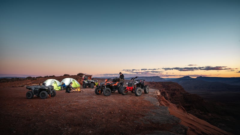
Bulldog Canyon, Arizona
Drive into the backcountry; camp. Wake up and drive deeper into the backcountry; camp. Repeat until you’ve exhausted the 34,000 acres of the Bulldog Canyon OHV Area, where 20 miles of marked trails cruise through the Sonoran Desert and the Goldfield Mountains, just an hour from Phoenix. The terrain is straightforward and suitable for beginners and families, but the scenery is off the charts. Primitive campsites along the trail make Bulldog Canyon an ideal multi-day destination for off-roaders looking to take their time and explore the nonmotorized trails within the canyon on foot.
Broken Arrow Trail, Arizona
Consider Sedona’s Broken Arrow Trail a hike in your side-by-side. The scenery is impeccable as you drive through the high desert of the Coconino National Forest, with views of red-rock canyons and towering buttes. The eight-mile out-and-back is wide enough for a jeep but can get technical at times as you climb sections of firm rock. Fortunately, it’s nothing the Polaris General XP 1000 can’t handle, with its 100-horsepower engine, 13.5 inches of ground clearance, and 30-inch tires that offer gecko-like traction.
Imperial Sand Dunes Recreation Area, California
Winds, time, and an ancient lake formed the Imperial Sand Dunes, a 40-mile-long system of sand mountains in southeastern California, 200 miles from Los Angeles. It’s one of the largest collections of inland dunes in the country, and temps often hit triple digits in the summer. Most of the off-road action happens around a palatial, 300-foot-tall dune called Oldsmobile Hill. It’s a social scene where you’ll find ATVs and UTVs of all kinds racing across the sand—the perfect setting to reap the benefits of RZR Turbo S ‘s 25” of pure suspension travel, which allow you to approach whoops and wide-open terrain with comfort and confidence.
Ouray, Colorado
Polaris’s General XP 1000 —a beast of a machine with 100 horsepower and 13.5 inches of ground clearance—might be the perfect vehicle for exploring Ouray and its surrounding slice of the San Juan Mountains, where hundreds of miles of unimproved roads and trails extend from town, climbing the steep San Juan backcountry. The area is known as America’s Switzerland because of the towering peaks and picturesque meadows. It’s also an adventure playground with world-class fishing, rock climbing, hiking, and mountain biking in all directions. The General’s oversize storage bed, which can hold up to 600 pounds of gear, will come in handy when you’re preparing for days of adventure.
Baumgartner Trails, Idaho
Backcountry is on the menu in this system, which has more than 200 miles of ATV and motorcycle trails ascending and descending the Sawtooth National Forest along the South Fork of the Boise River. Many of the trails are limited to vehicles no wider than 48 inches, perfect for the Polaris Sportsman 570 , with its narrow footprint and True On-Demand all-wheel drive. Think technical singletrack with steep pitches, sheer drop-offs, narrow switchbacks, and lots of rock scrambling. Bring your camping and fishing gear—or set up at the Baumgartner Campground, which has a hot-springs-fed soaking pool.
Moab, which might be the most OHV-friendly town in the country, is surrounded by countless acres of off-road bliss, from mellow old mining roads to rock-crawling adventures. The slickrock is the draw here, offering waves of grippy rock seemingly built for off-road vehicles. Ride Poison Spider Mesa, a hybrid of dirt and rock, and you’ll see arches and petroglyphs. Add a hitch rack to your Polaris General and you can bring your mountain bikes with you to access some of Moab’s signature bike trails. Or load up your RZR , including cold drinks and lunch in the Polaris Northstar cooler , which has multiple tie-down points for easy securing, for an all-day adventure.
Paiute ATV Trail, Utah
The Paiute has more than 2,000 miles of routes traversing Fishlake National Forest and BLM land in south-central Utah. Don’t worry: with Polaris’s RIDE COMMAND GPS navigation system , you’ll always be headed in the right direction. The 7-inch, in-dash screen allows you to plan and create your route before you put tires to dirt. If you’re riding with others, you can keep track of everyone on the display in real time. It will come in handy on the Paiute, which centers around a 275-mile loop that passes through small towns, but accesses limitless side trails that extend deep into Utah’s backcountry. Expect anything from firm, packed roads to gnarly switchbacks on narrow trails.
Always moving, forever searching, never at rest. Our passion for the outdoors unites us, creating a bond that goes beyond the mechanical. Our off-road vehicles take you where others can’t – from the remote hunting stand covered in snow and brush to the race track in the desert sun and anywhere in between. Think Outside and find your own new adventure with Polaris.
Popular on Outside Online
Enjoy coverage of racing, history, food, culture, travel, and tech with access to unlimited digital content from Outside Network's iconic brands.
Healthy Living
- Clean Eating
- Vegetarian Times
- Yoga Journal
- Fly Fishing Film Tour
- National Park Trips
- Warren Miller
- Fastest Known Time
- Trail Runner
- Women's Running
- Bicycle Retailer & Industry News
- FinisherPix
- Outside Events Cycling Series
- Outside Shop
© 2024 Outside Interactive, Inc
THE 5 BEST 4WD, ATV & Off-Road Tours in Idaho, United States
4wd, atv & off-road tours in idaho.
- Golf Courses
- Gear Rentals
- River Rafting & Tubing
- Fishing Charters & Tours
- 4WD, ATV & Off-Road Tours
- Up to 1 hour
- 1 to 4 hours
- 4 hours to 1 day
- 5.0 of 5 bubbles
- 4.0 of 5 bubbles & up
- 3.0 of 5 bubbles & up
- 2.0 of 5 bubbles & up
- Big Green Adventure Tours
- Perrine Bridge
- Evel Knievel Snake River Canyon Jump Site
- Buzz Langdon Visitor Center
- Likely to Sell Out
- The ranking of tours, activities, and experiences available on Tripadvisor is determined by several factors including the revenue generated by Tripadvisor from these bookings, the frequency of user clicks, and the volume and quality of customer reviews. Occasionally, newly listed offerings may be prioritized and appear higher in the list. The specific placement of these new listings may vary.
1. Guided Half-Day Tour to Shoshone Falls & City Tour
2. Guided Half-Day Scenic Tour - Off The Beaten Path
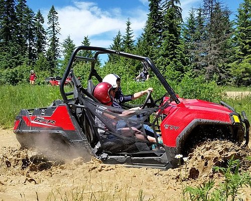
3. Guided Off-Road Vehicle Tours in North Idaho Forests
4. Private Targhee NF, Palisades, Snake River, Swan Valley, and Mormon Row Tour

5. Yellowstone & Grand Teton Nat'l Parks Day Tour - Private Tour

6. Guided Full-Day Tour to Craters of the Moon National Monument & Preserve
7. Guided Half-Day Tour to Dierkes Lake & Shoshone Falls

8. Guided Half-Day Tour Scenic Adventure & Wine Tasting Tour

9. Yellowstone Snowshoe Adventure - Private Tour from Jackson Hole
What travelers are saying.
- Bear's Books

Off-Road Trips: Best Spots in the US for Your Off-Road Vacation
By Outdoors.com
Looking to add a little excitement to your life? Off-road trips are an exhilarating way to experience the outdoors. Whether you’re a newbie or someone who jumps in their 4×4 to explore every weekend, off-roading is a great way to explore a different area of the world, or even you’re own backyard. Here are some of the best places in the US to go on and off-road or ATV adventure.
Oregon is one of those hot spots that make the great northwest such a fantastic place for off-road vehicles. The dunes scattered throughout the Oregon Coast make for an exciting and bumpy ride, and the coastline is one of the most aesthetically pleasing sights – serving as a breathtaking back drop for the thrill of off-road riding.

Some of the best spots are located in the deserts of the Southwest. Arizona offers a lot of beautiful scenery – from the smooth desert landscapes to rocky canyons and cliff sides. The scenic sunset and cool evening, as well as extremely dry weather, create the perfect experience for outdoor fun. The Sunflower mine area near Payson, AZ has 4 exceptional peaks with trails higher than most. The Raw Deal upper and lower trails in the north Phoenix area offer fantastic ATV and off-roading experiences – with tons of obstacles at different levels of difficulty, great for the first-timers as well as the old pros.
West Virginia has taken advantage of its lush green scenery, creating a variety of recreational sites to serve those who love the outdoors . They now have many off-road tracks, specifically made for dirt bikes and ATV’s. Since these trails were made to thrill off-road riders, you can be sure that they are just that, a thrill. Burning Rock ATV trails in Southern West Virginia is one of the area’s favorites, and they also offer zip-lining.

Tennessee is another place that has received a lot of attention from those who enjoy off-road riding. Coal Creek OHV Mountain is considered to be one of the best spots in the country. This should be at the top of your list!
There are plenty of other great outdoor havens specifically for those looking for some off-road adventure. A lot of the best places mentioned here have accommodations near by, making it easy to stay and prolong your outdoor off-roading experience to get the most out of your trip. Enjoy!
Related Tags:

Here’s What to Get Outdoorsy Guys for Father’s Day

Beautiful White Bison Born in Yellowstone National Park
Leave a comment cancel reply.
Your email address will not be published. Required fields are marked *
Save my name, email, and website in this browser for the next time I comment.
Register for newsletter (optional)
More Like This

Granite Gear Packable Duffel

MountainSmith Roll Top Cooler Review

The Innate Outdoor Travel Towel Dries Quickly Camping

10 Tips For An Incredible Bike Picnic

Hiking Prime Day Deals You Don’t Want to Miss

2014 Holiday Outdoors Gift Guide

Gear of the Year Awards 2016: Campfire Defender

Aspect Solar Energy Bar 250 Overview
More stories.
You are using an outdated browser not supported by this software. Please upgrade your browser .
- Housing & Real Estate
- Living on a Budget
- Personal Finance
- Camping & Outdoors
- Destinations
- Vacation Rentals & Hotels
- All Cars & RVs
- Maintenance
- Makes & Models
- All Shopping
- Beauty & Fashion
- Home & Garden
- Kitchen & Groceries
- All Reviews
- All Food & Drink
- Beer, Wine, & Spirits
- Food Trends & Trivia
- Restaurants & Dining
- Taste Tests
- All Lifestyle
- Entertainment
- Health & Wellness
- Life After 50
- All Gift Ideas
- Gifts by Interest
- Gifts by Price
- Gifts for All
- Gifts for Her
- Gifts for Him
- Gifts for Kids
- In The News
- Privacy Policy
- Terms & Conditions
Copyright ® 2024 Cheapism
25 Epic Off-Road Adventures Across the U.S. and Canada

_DSC9525 by Powhusku ( CC BY-SA )

Roads? Where We're Going, We Don't Need Roads
The landscape of North America is vast and home to a variety of different terrain. While there are extensive highways stretching across the U.S. and Canada , there are plenty of looser, or even unmarked territories, for adventurous drivers to explore. We looked up some of the best off-roading destinations on each side of the border to find these 25 great spots for Jeep, 4x4, ATV, or dirt bike adventures.
Related: Barstool Racing and Other Strange Motorsports You Didn't Know Existed

Hawk Pride Mountain Off-Road Park
Tuscumbia, Alabama USA Today recommends this park with more than 90 trails , where level-five trails are considered "hardcore territory" and recommend "a big roll of toilet paper and extra set of underwear." All rock-crawl trails are 100% natural rock, the site guarantees.
Related: 22 Bucket-List Experiences for Adrenaline Junkies

Byrd's Adventure Center
Ozark, Arkansas The Ozarks offer plenty of rough terrain to challenge your 4x4s. Arkansas Jeep dealer McLarty Daniel recommends heading to Byrd's , where there's trails from beginner to "Red Trails," for which even expert drivers are recommended to equip their Jeep with roll cages. In between, there's a rock garden and obstacle course for $15 for motorcycles and ATVs and $20 for four-wheel-drive vehicles.
Related: Why People Are Crazy About Jeeps and Why You'd Be Crazy to Buy One

Hot Springs ORV Park
Hot Springs, Arkansas This park is recommended by the state tourism office , the Arkansas Times , and off-roaders alike. For $33 a day or half that for bikes and ATVs, drivers get access to rock-crawling trails of every difficulty level, all well marked so you don't get in over your head.
For more fun auto stories, please sign up for our free newsletters .

Flagstaff, Arizona
There's plenty of off-roading sites all around Arizona, including seven at Lake Havasu and six around the Grand Canyon, but Flagstaff has 13 areas offering a selection of trails, according to AZOffroading.com . There are easy courses at Lockett Meadow and the 10-mile Elden Mountain Lookout Run , and more difficult challenges such as Soldier Pass, which only permits 12 motorists per day and Greasy Spoon, which only gets harder when the rain turns the terrain to mud .

Whipsaw Trail
Princeton, British Columbia A popular course for Canadian off-roaders, and one of BF Goodrich's past picks for outstanding trails, driving dry through the BC woods is quite different from when the mud gets wet enough to cling to your tires. Even on dry-weather days, you'll drive through some ponds while overlooking the Cascade mountains east of Princeton. There are plenty of friendly Canadians to help you out in a pinch.
Related: 30 Best Summer Travel Destinations in Canada

Rubicon Trail
Near Pollock Pines, California This famous — or infamous — 22-mile stretch of road never presents the same route twice. Fourwheeler.com warns of falling trees and shifting rocks , and The Last Great Road Trip, a team of off-road adventurers that writes about its exploits online, chronicled 2009 and 2013 treks . The 23rd annual Jeep Jamboree Rubicon Trail trip , taking place Aug. 12-15, has a long list of requirements for those wishing to participate, including 1997 or later Jeep Wranglers with 35-inch tires (but less than 40 inches), front and rear lockers, tow points, skid plates, and rocker panel protections.

Ouray, Colorado
With more than 40 off-roading trails, Ouray more than earns its claim as the "Jeep Capital of the World." Old mining roads have transitioned the Ouray economy from industry to tourism, as drivers from all over come to experience trails that The Washington Post reports . are either "mellow scenic" or "gnarly scenic," with little interpretation in-between.
Related: 24 Timeless Jeeps Everybody Still Loves

Redneck Mud Park
Punta Gorda, Florida Once called the Redneck Yacht Club , it's easy to see how the Redneck Mud Park does for off-roading what yachts do for sailboats. The Mud Park hosts races in four unique "mud holes," plus truck pulls and miles of free-riding trails that can accommodate ATVs, side-by-sides, trucks, Jeeps and buggies. A pass (when it's open) includes camping, and the concert stage often hosts non-vehicular entertainment. Mud Life Magazine writers liked it so much they went back !
Related: 43 Most Over-the-Top Trucks You Can Buy

Lanai, Hawaii
The islands of Hawaii are full of lush greens, tropical springs, and volcanoes , so there must be some spectacular spots to drive off the tourist-clogged roads. The Orange County Register recommends Lanai for its red rocks and dirt, which it compares to the Martian landscape. If you make it all the way across 400 miles of unpaved roads without getting stuck, you'll see sights such as a wrecked tanker and the mythically inspired Garden of the Gods .

The Cliffs Insane Terrain Off-Road Park
Marseilles, Illinois The Travel Channel recommends this 300-acre park of fields, creeks, and mud. Cliffs Insane offers day passes starting at $25, with discounts for children, and passengers. Jeeps and trucks are no longer allowed.

Attica, Indiana In the middle of farm country, there's this wet, dirty oasis for 4x4s. Driving Line raved about its Jeep-sized drainage tubes dropping into deep water, steep rocks, and the 20% of the park for four-wheelers only. ATV Illustrated, calling the spot a "hidden gem," enjoyed the portion of Badlands that allowed three-wheelers to succeed where Jeeps couldn't. For dry off-roading fans, there are sand dunes, gravel, and woods , and there are rental vehicles, too.

High Lifter Proving Grounds
Shreveport, Louisiana Off-road accessory manufacturer High Lifter opened its own mud park on the bayou. Off-Road.com tested out High Lifter's snorkel breather system — designed to keep engines running in deep mud — by submerging a Polaris underwater . Race-deZert did the same and helped other stuck drivers before promptly getting stuck themselves.
Related: These Game-Changing Monster Trucks Will Take You Back to Childhood

Cape Cod, Massachusetts
This beach vacation destination could also be an off-roading paradise in New England. The Cape Cod seashore grants permits for off-road vehicles on the beach, and nearby Nauset Beach has seven sand-dune trails that are accessible if you get the permits . As Cape Cod Online reminds off-roaders , be sure to go out at low tide if you want to have enough sand to drive on, and be sure to exercise caution in areas where there might be pedestrians and sunbathers to avoid accidents. Some trails have temporary closures for bird nesting so check before you go.
Related: 20 Things You Never Knew About New England

Assateague Island Beach
Berlin, Maryland This small island on the eastern shore has room for up to 145 permit-holding, over-sand vehicles for beach driving. Permits are annual , not daily, and the Maryland and Virginia portions of the beach have different closing schedules. Area group Capital Off Roading Enthusiasts experienced all 12 miles of sand on a windy day , and caught glimpses of dolphins, storm-wrecked houses, and seashells.

The Upper Peninsula of Michigan
On the land between Lakes Superior, Michigan, and Huron, there are more than 50 ATV/ORV trails , including one that goes through Lake Superior State Forest . The Midwest winter climate means frozen ground and ice, with summers thawing to loose, wet mud. Upper Peninsula Overland leads ecotourism trips where the goal is to traverse the terrain gently, not tear up the mud.

Red River, New Mexico
If the Gold Rush pioneers could make it through the Red River trails on horse and carriage, gas-powered 4x4s should have no problem. You'll drive winding roads from mine caves and lakes up mountains as high as 11,500 feet , and Red River also has been known to offer professional drivers for tours . Red River is also close to Goose Lake and Cabresto Lake , and both offer more opportunities to test your off-roading skills.
Related: 18 Towns Where You Can Still Experience the Wild West

Logandale Trail Systems
Clark County, Nevada Sure, you can take an off-roading excursion from Las Vegas like every other tourist, but there's plenty of desert and sand farther out with great canyon views. The Logandale loop shows up on many Nevada 4x4 sites such as Vegas Valley 4 Wheelers and Dixie 4 Wheel Drive . Trails take you over cliffs, or you can climb the rocks for an added challenge, but leave the petroglyphs alone and remember that flash flooding can occur when storms move in.

Uwharrie National Park
Troy, North Carolina Uwharrie spans three North Carolina counties and offers rocky routes for experienced drivers over four marked trail areas . Making the steep climb to the top of the Uwharrie mountains is a badge of honor.
Related: 32 Most Reliable Trucks of All Time

Disney, Oklahoma
This Disney may not have Mickey Mouse or Donald Duck, but it is a magic kingdom to off-roaders. A rock garden, hills, and trails below the Grand River Dam offer a virtual roller coaster for 4x4s. You can get there through any of the five nearby state parks, and the city sells $5 maps of all the trails.

Concession Lake, Ontario
While few parts of Ontario permit off-roading, Concession Lake welcomes drivers. The trail here will make drivers climb over Canadian Shield rock, squeeze between trees, and try to remain unstuck in the mud and water. Those puddles only get deeper after rain, and in winter snowmobiles take over the trail.

Rausch Creek Off Road Park
Pine Grove, Pennsylvania Pennsylvania Jeep and Toyota dealers send drivers to Rausch Creek to splash in the mud or conquer the steep rocks. Rausch Creek is for Jeeps, trucks, or SUVs only , and your party must include at least two vehicles. There are more than 60 miles of terrain, including a human-made concrete and all-natural rock crawling course where you can test your skills.
Related: 30 Most Iconic SUVs of All Time
The red rocks and canyons of Moab make it "America's Off-Road Capital," according to 4x4 drivers. Off Road Extreme chronicled dune jumping, the sheer drops of Hell's Revenge, and the Hot Tub, a deep bowl that threatens to eat 4x4s. Jalopnik advises those popular obstacles are only a small portion of Moab's off-roading opportunities, and encourages exploring other trails, too. Beware the slickrock, though.
Related: 31 Bucket-List Experiences in America's National Parks

Hatfield-McCoy Trails
Mingo County, West Virginia The rivalry of the West Virginia Hatfields and the Kentucky McCoys has died out, but the West Virginia trails bearing their names come highly recommended. Western U.S.-based Dirt Toys Magazine compares the trail system favorably to Moab, describing the forested backwoods as "kick butt picturesque." Bear Wallow is the only trail in this system that allows 4x4s , with trails widened for full-sized vehicles — but that doesn't mean they're easy,

Washington Backcountry Discovery Route
Cascade Mountains of Washington Last Great Road Trip took a portion of this nearly 600-mile route, from Seattle into Canada, although you can actually start as far south as Oregon. Brush had to be cleared ahead of the Toyota being used, and the road was shared with cattle. A Four Wheeler crew found itself moving whole trees out of the way . Driving along the Cascades, pretty much anywhere you stop offers a tremendous view.
Related: 33 Greatest American Trucks of All Time

Morrison Jeep Trail
Park County, Wyoming The treacherous Morrison Jeep Trail ends up on many lists of Wyoming's 4x4 trails, including one from Dangerous Roads . It's only one lane for most of the 22 miles up extremely steep terrain, with rocky patches demanding high clearance vehicles . You've only got June to September to attempt the trail, as snow makes it prohibitive during the long winter.
Related: 20 Heart-Stopping Roads to Drive Around the World

How to Plan an Off-Road Camping Trip Like a Pro
Word and Photos by : Amanda Zito | As the Magpie Flies Edited By: Kate Weber
Ever wanted to try camping off-the-grid, but don’t know where to start? We all know the best way to jump into something new is to learn from an expert. Amanda spends her life riding one of her five motos on long-distance trips that span the country, avoiding hotels and cooking all her own food along the way. So, she is exactly the person we want to show us the ropes. Here’s Amanda’s guide to off-road camping. Learn everything you need about what gear to pack, ways to keep yourself safe, and how to use onX Offroad to plan your route.
Even if you don’t ride moto, we bet you’ll find this guide useful for any type of off-road camping adventure.
Find Your Style
Everyone camps and travels differently. Everyone needs different things to feel comfortable. It’s important to approach your first few camping trips as experiments, where you document what worked and what didn’t work, what needs to be improved for you to have a better time, and so on.
For me, motorcycle camping is a fantastic way to overland and experience everything our wonderful public lands have to offer. Fuel efficiency for motorcycles is amazing. Seriously, it could cut down your projected fuel costs for a trip by half at least. Being exposed to the elements means there’s no barrier between you and the world around you. This guide is geared towards a moto-camping trip, but can be utilized for other types of vehicles, too.
So let’s start with the basics. First things first, all the camping gear in the world won’t be useful to you if you don’t know how to plan your route or find camping.
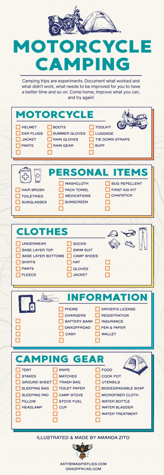
Plan Your Route & Find Camping
You can either plan your route and then find camping along that route, or your route can be created by traveling from campsite to campsite. It’s important to know how to do both, in case you are in a pinch and the spot you planned for is full or closed. Good news: onX Offroad shows you campsites on your map! There are a few ways you can find camping using the App. I usually just scan the map and look for the tent icons—the icons show both designated campgrounds and places you can disperse camp.
Don’t know what dispersed camping is? I also have a handy video explaining what dispersed camping is and the rules you need to follow here .
Tips for Choosing Where to Camp
For your first-ever time camping, I would recommend picking a developed campground with water and toilets. The other plus is if you find you’ve forgotten something or you need help there will be others around who you can ask for help.
When picking a location, keep in mind the higher elevation you camp at the colder it will be at night, so make sure you’re prepared for the temperature to drop a little more than you might be used to. If you camp near any body of water or a river, the air will also get a little chillier at night as the cold air off the water wafts up to where you’re camped. Bodies of water also mean a good amount of bugs and mosquitoes, so don’t forget your bug spray. Wide-open areas with no trees could also be quite windy so be prepared to stake out every line on your tent to keep it from whipping when the wind picks up.
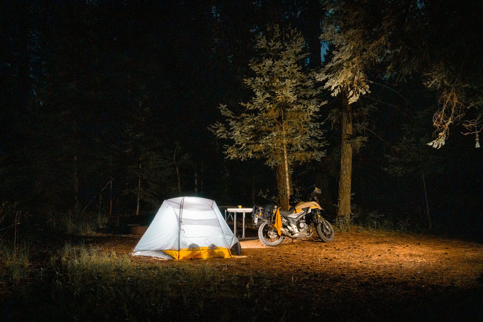
Practice Leave No Trace Camping
Remember to Leave No Trace , and always leave a campsite better than you found it. Do not throw your trash or beer cans in the fire pit. It is not a trash can. Pack it out and dispose of it properly. Do not leave toilet paper in the bushes or in your cat hole ( how to poop in the woods ). Wild animals often dig up your waste and will spread that toilet paper all over. It does not compost as fast as you think it does. If you have to camp in a place that does not have toilets, you should have a separate Ziploc bag to pack out your used toilet paper -or look into a backcountry bidet.
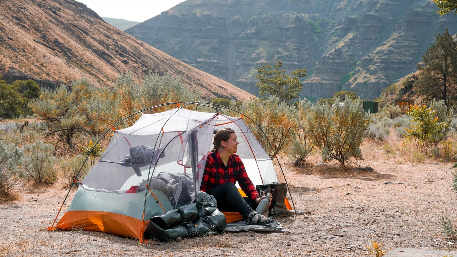
The List of Essentials
There’s a list of items in backpacking called the ten essentials. They can be applied to camping as well.
- Navigation : map, compass, or a GPS device or satellite messenger. onX Offroad maps work offline — just remember to download your maps before you go. It’s also good to have a backup map just in case you lose your phone.
- Sun protection : sunglasses, sun-protective clothes and sunscreen. You can still get sunburned on your face even if it is overcast.
- First Aid Kit: including insect repellent, burn care, and some kind of wrap to secure broken bones.
- Knife & Gear Repair Kit
- Fire : matches and a lighter. Always carry two ways to light a flame.
- Extra Food : I always carry an extra can of soup and some energy bars just in case I get stuck somewhere for whatever reason.
- Extra Water: Hydration is so, so important. Having a water bottle or a hydration bladder is good, but you should also have some kind of water storage like a dromedary bag, and a way to treat water.
- Extra Clothes
Other items to consider taking:
- Battery Pack to charge your phone
- Camp Shoes – sandals or other packable shoes
- Biodegradable Soap -this would ideally be something you would remember to bring as apart of your camp kitchen, but it’s important enough that I wanted to add it here
- Gallon Ziploc bag for trash – or a larger bag to carry out your trash if you’re in a group
- Compact Camp Chair – many people enjoy the luxury of not sitting on the ground, if you’ll be camping at a developed campground with picnic tables this might be overkill though.
Some notes on safety: You should also consider carrying a set of tools for your motorcycle (or the vehicle of your choice). Even if you don’t know how to use those tools, or how to work on your bike, it is better to carry them in the chance that you need help and run into someone who knows how to use them. Make sure your tools are appropriate for your motorcycle as well whether that’s Metric or SAE. I have a whole video on what to do if you break breaks down that is linked in the Additional Resources section.
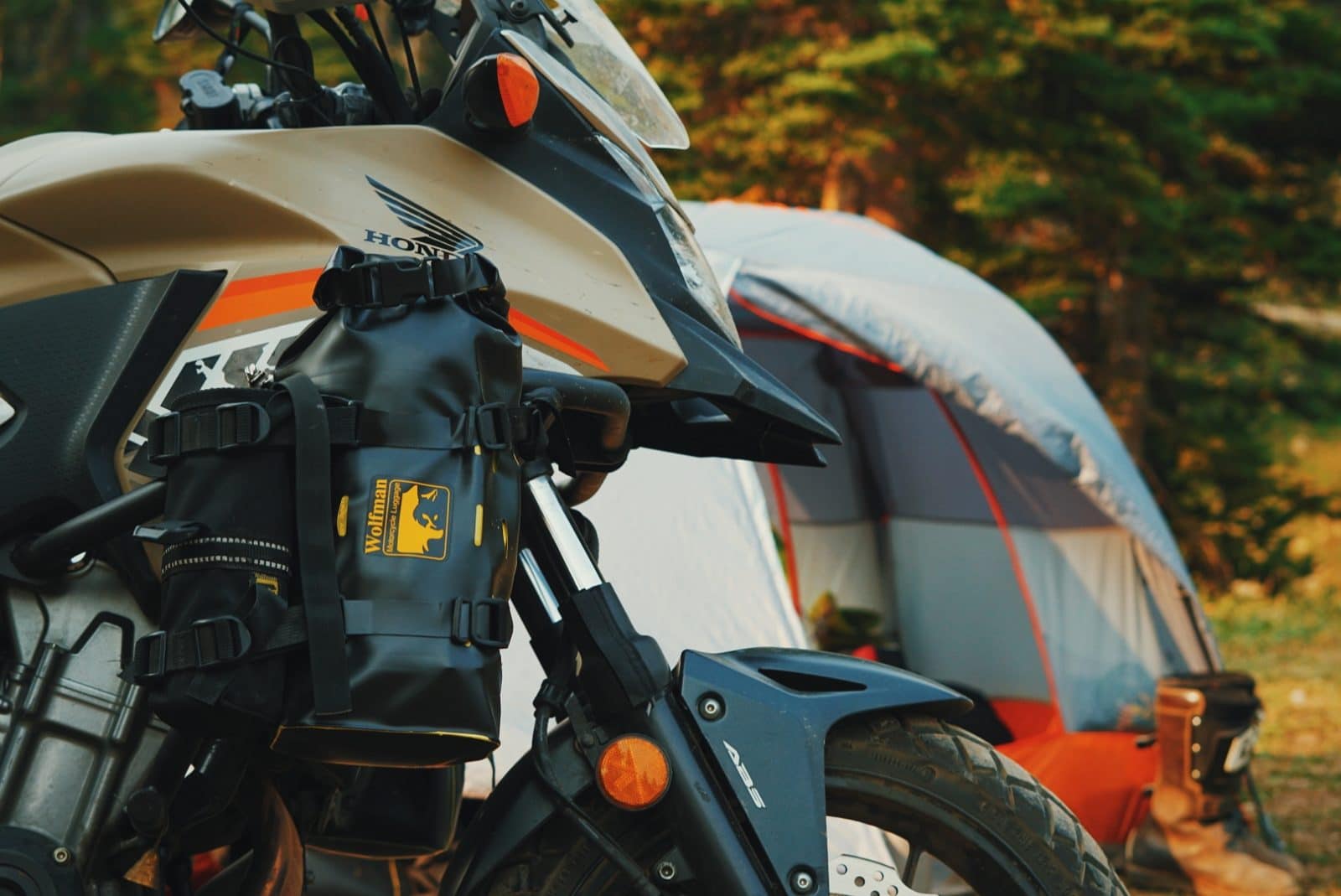
Now Onto Gear
At the core of it, you just need a shelter and a sleep system to camp. So let’s start with that.
I recommend beginner motorcycle campers start with a tent as their shelter and branch out to other kinds of shelters (like hammocks, tarps, a bivy, or pull-behind pop-up trailers) if they interest you.
Most entry-level backpacking tents around the $200 mark are where I recommend people start.
Wait for sales, like Black Friday, buy used, or rent if you’re really unsure if you’ll like camping or not. (I’ll talk about more resources for buying quality camping gear on a budget a little later in this post!)
Yes, there are cheaper dome tents out there from big box stores. I discourage people from going this route because if it turns out you do like camping, you’ll want to upgrade your tent sooner than later. Speaking from experience, these cheap tents will deteriorate quickly, are more frustrating to set up, and will not hold up to the elements over multiple trips.
If you’re camping by yourself a 2 person tent is a good place to start, if you’re taking a partner with you think about getting a 3-4 person tent. Single-person tents will not have space for you, your sleep system, AND your gear.
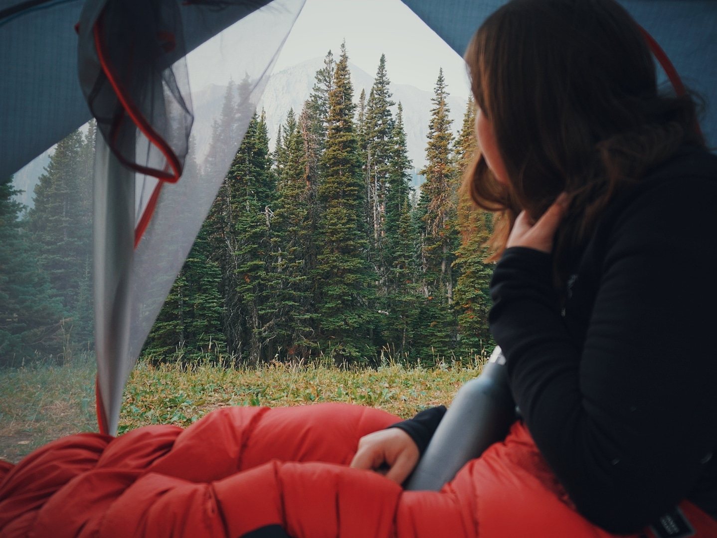
Sleeping Bags & Pads
In general, there are two different kinds of sleeping bags you can get: down-filled or synthetic-filled. They come in all different shapes, sizes, and temperature ratings.
As a general rule, I recommend most people get a 20 or 30-degree sleeping bag for their first bag. If you live in a tropical area, or a place where the temperature rarely drops below 60 at night, you could go for a 40-50 degree bag.
- Down sleeping bags are lighter, pack smaller, and you get a higher warmth to weight ratio. They also tend to be more expensive. The argument many have against down sleeping bags is that if they get damp or wet they lose their insulating properties, whereas synthetic sleeping bags will still insulate when wet. My counter argument: If your sleeping bag gets wet you’re not going to want to sleep in that even if it did still insulate you. It would be so uncomfortable you wouldn’t sleep and the dampness would transfer to your body, which if it was cold and windy, could lead to a threat of hypothermia.
- Synthetic Sleeping Bags tend to be a bit bulkier, heavier for the temperature rating that you get, and the warmer it is the bigger and heavier it is. However, they also tend to be cheaper than down.
- Sleeping pads are just as vital to your sleep system as your sleeping bag. Whether that’s a closed-cell foam pad, self-inflating pad, or an air pad. Sleeping Pads have a thing called an R Value rating, which rates how well the sleeping pad will insulate you from the ground. 0 being the lowest rating which means there’s no insulation in it so it’s only suitable for conditions 50°F and warmer. All the way up to 5.5 and higher which means it will keep you insulated in very cold temperatures. In general, I recommend beginners to use an insulated air pad with an R Value of at least 2 if not 3 or higher. As many of the other options of sleeping pads are very large and bulky to try and pack on a motorcycle.
Layering is important no matter what time of year you’re going camping. You’ll want to take the weather into account and plan appropriately. I always recommend bringing one or two warm layers even if it’s hot when you leave, so you’re not caught off guard when the temperature drops at night, or if it suddenly decides to storm. Better to carry a puffy down jacket and not need it than leave it at home and be uncomfortably cold once the sun goes down.
Invest in base layers made of merino wool or synthetic fabrics, fleece jackets instead of cotton hoodies, and down packable jackets, instead of bulky layers. Remember the rule, no cotton in the backcountry.

Cooking Gear
It’s a great idea to have some kind of compact camp stove and pot to make hot water so you can make yourself your beverage of choice and maybe heat up some water to make some dehydrated meals or heat up a can of soup.
As you get the hang of camping, you can branch out and experiment with making more ‘complex’ meals at camp. I have a whole video all about setting up a versatile camp kitchen that works for YOU here where I dive into all the different kinds of pots, camp stoves, fuel types, etc.
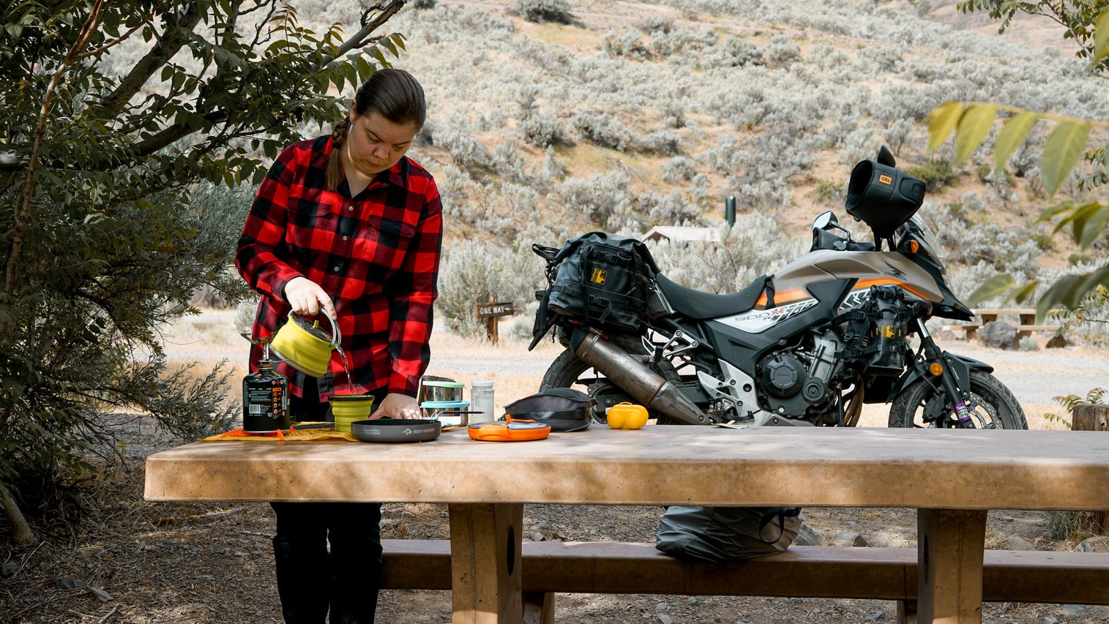
Safety from Animals and Humans
Depending on the area you’ll be camping in changes the kind of animals you should be aware of. If you’re in a bear active area, read up on information from credible sources for the best way to take care of your food and anything with a smell (i.e. toothpaste, deodorants, soaps, etc.) when you’re in bear country. That is imperative for your protection but also the protection of the animals. Some bear active recreation areas will require you to carry a bear canister and bear spray.
Even if you’re camping in an area that doesn’t see a lot of big game activity, it’s important to keep your food stored away from your tent, and clean up your food immediately after you’re done with it, and put it away between meals. Keeping your food, kitchen equipment, AND trash, tidy and cleaned up is important to protect it from any rodents and birds—which are the most frequent campsite visitors.
I can’t emphasize enough how helpful simple things are like; being aware of your surroundings, knowing your exits, don’t put yourself in a position where you can’t get out in a hurry, listening to your gut if you don’t feel comfortable or if you genuinely don’t feel safe, but don’t let your brain go over the top imagining scenarios that only happen 1 time out of a million.
I tend not to leave the bike alone when it’s fully packed. If I go into a restaurant to eat, I will try to find a restaurant that has a big window that faces the parking lot and ask to be seated in a place where I can keep an eye on my bike. I also always bring valuable items like electronics with me, whenever I leave the bike for more than five minutes, even if I’m just popping into a grocery store. Something I learned after having a tripod stolen in a National Park, is that people go for the easy-to-grab items that they can see. The more well-packed you are so everything is stowed away and not in the open the less likely someone is to steal it. When I go camping I’m normally in that place for one night and I move on. If I’m planning on spending more than one night in a place I tend to gravitate towards campgrounds with a camp host, so I know someone is making the rounds on the regular.
That’s a start anyway, if you’re still hesitant because you’re worried about other people, there are lots of great basic self-defense classes all over the place that can really help boost your confidence and courage.
I know that just scratched the surface, but it is a BIG topic!
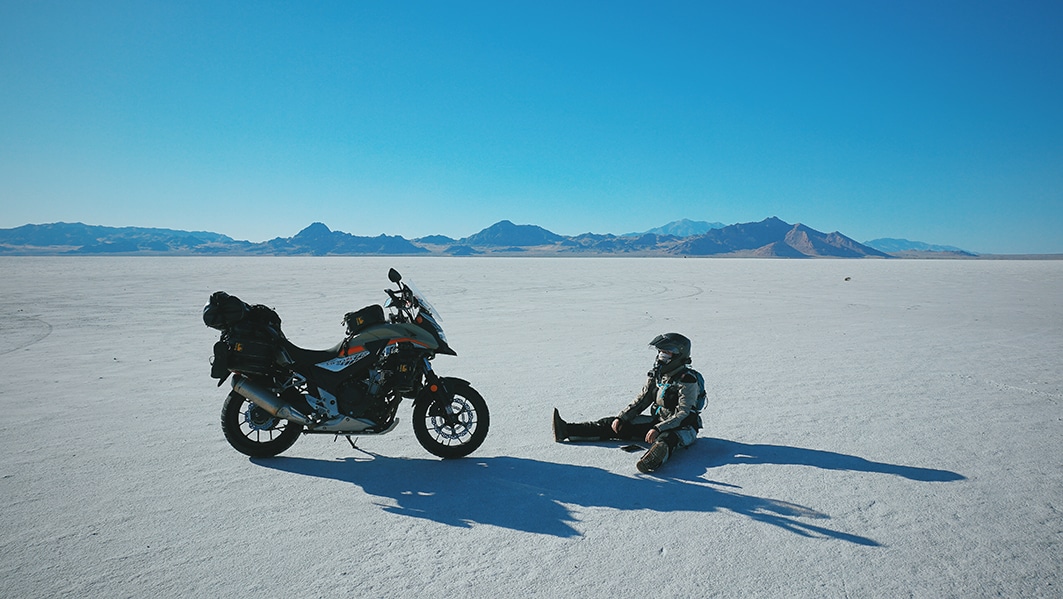
Getting Gear On A Budget
Let’s face it, camping gear is expensive . Here are a few tips for getting the gear you need and being as budget-friendly as possible.
In a nutshell:
- Do your research, look for an older model year.
- Buy Strategically during the off-season and Seasonal Sales.
- Check Online Discount Websites.
- Buy USED from local thrift stores and online for used outlets.
I have a whole video on the topic of buying camping quality camping gear on a budget that you can watch here .
Additional Resources
These are the need-to-know basics for getting into off-road camping, but I have a lot more resources specific to motorcycle camping and for those who are interested in diving deeper. Here are a few I recommend:
- Video: How I Chose My Motorcycle Saddlebags
- Video: What If I Break Down On My Trip?
- For everything you could need, I recommend The Fundamentals of Motorcycle Camping by my friend Tim Collins .
- Check out the beginner off-road trails near you.
- How to Tie a Tie
- Best Coffee Beans
- How to Shape a Beard
- Best Sweaters for Men
- Most Expensive Cognac
- Monos vs Away Luggage
- Best Luxury Hotel Chains
- Fastest Cars in the World
- Ernest Hemingway Books
- What Does CBD Feel Like?
- Canada Goose Alternatives
- Fastest Motorcycles in the World
Mastering the trail: Essential tips and gear for off-roading adventures
Off-roading 101: what you need to know.

When the urge to explore arises, few drivers ever find their way off the pavement. And really, they don’t have to; the most popular U.S. campsites , landmarks, and panoramas can be accessed via roadway. But to access more original vistas and tell more compelling stories, you’ll need to go off-road.
- What you’ll need to go off-roading
What does what
What you might want for off-roading, tips for driving off-road.
Thankfully, doing so is easier than ever. No longer do you need to sink years of effort into modifying your rig; several automakers will happily sell you a brand-new vehicle with more off-road goodies than you’ll likely ever need. And if you still prefer to do your own modifications, the aftermarket community is packed with options at all price levels.
In this article, we’ll cover the basics of off-roading, because whether you have a crossover or a Jeep Gladiator Rubicon , you can explore far more than a fire road with the right equipment and fundamentals.
What you’ll need to go off-roading
Whether your vehicle is old, new, or two- or four-wheel drive, here are some essentials to equip yourself with before you hit the trails:
- What does sport mode do? This car feature explained
- 2024 Toyota Land Cruiser: Tech, off-road chops, pricing, and more
- Simple garage organization tips for better car and motorcycle care
Just like some people believe all-wheel drive will magically cure wheel slip in the snow, others imagine a transfer case or locking differential will overcome any tire inefficiencies off-road. Unfortunately, if you attempt to drive across mud, rocks, or sand in summer tires (or worse, balding or cracked ones), you’re asking for trouble. Different tires are specifically developed to handle different environments.
A mud-terrain (M/T) tire will make some noise on the road, but it will also eject mud, snow, or sand quickly to help you coast through the mucky, loose stuff. Similarly, if you live in a snowy area, it would be safer if you use the best snow tires on your off-road vehicle.
An all-terrain (not to be confused with all-season) tire is another good choice for those who expect to encounter a wide variety of surfaces, but likely aren’t planning to do anything too hardcore. Size your tire according to what fits and turns easily in your vehicle’s wheel wells. Larger tires provide more ground clearance and a bigger contact patch, but if you go too big, you’ll need to re-gear your axles or transmission to avoid power loss and poor fuel economy.
Recovery gear
A good set of tires will help keep you out of trouble, but if you get stuck, you’ll be thankful for recovery gear. Among the must-haves are MaxTrax traction pads to help you extract and plow through loose terrain, snatch straps to attach to another vehicle’s recovery points and pull you from a snag, a high-lift jack, and base to elevate your rig and change a tire on any terrain.
Additionally, you need a patch kit to cover a tear in your tire temporarily, a shovel to, uh, dig yourself out of trouble, work gloves to save your fingers and palms, a headlamp or other light source to illuminate the issue (which often happens during the inconvenience of night), and a jump starter to overcome a dead or faulty battery. You can get fancy with equipment like winches, but keep in mind that these carry a hefty weight penalty (not to mention expense) and aren’t necessary for the average off-roader.
We’ve all seen the weekend warriors with about thirty LED, halogen, and HID lights pointing in all directions. That doesn’t need to be you (and unless you have a very specific use case, it shouldn’t be you). Really, all you need is a good set of driving lights that cast a wide enough beam far enough into the night. If your stock headlights aren’t cutting it, an easy solution is to attach a set of auxiliary driving lights to your front bumper with a switch wired somewhere on your dashboard.
If you want to go the extra mile, consider a set of spot/search lights that can be mounted near your door mirrors to illuminate the left and right sides of a path ahead. Yes, LED light bars look cool and can be useful, but they can also create problems if incorrectly mounted (think intense glare off your hood), so be sure that’s what you want.
Emergency gear
The tires didn’t keep you out of trouble and the recovery gear couldn’t free you from it – now what? Plan and prepare for these emergency situations before the fact. If you’re overlanding or headed to a campsite, chances are that you packed sufficient food and water for a couple of days, but if not, you’ll always want some rations and water stashed on board. Bundled with these essentials should also be a set of warm, waterproof clothes (yes, even if the weather report is favorable).
In the event of a rollover or similarly dangerous predicament, you’ll want a seatbelt cutter or glass breaker somewhere on your person or easily accessible. Of course, a first-aid kit is a must. And if you’d rather not wait until you’re found, it’s a good idea to buy a long-distance radio with a spare battery to alert anyone nearby. If you’re driving in snow, you will also need snow tires, an ice scraper, and a roadside emergency kit.
Depending on your vehicle, the driver’s seat can give you access to a vast array of switches, buttons, and levers, inviting the question: What do you activate, and when?
Traction control
Whether you have two-wheel drive, all-wheel drive, or four-wheel drive, if your vehicle was made in the last decade, it probably has some form of traction control. The most basic iteration of this is a simple on/off setting, but vehicles designed to tackle various climates and terrain will come equipped with multiple configurations that adjust throttle mapping, braking, and/or power distribution to limit wheel slip and therefore overcome obstacles. If you have an on/off switch, your best bet is to keep the system off when you’re off-road – this will prohibit the vehicle from applying the brakes at the first hint of traction loss. If your system has multiple settings, do a bit of homework via YouTube videos, forums, or your user manual to see what setting is best in which conditions.
4WD high vs. 4WD low
If you do have a 4WD vehicle with a two-speed transfer case (4WD Hi and 4WD Lo), you’ll need to know how and when to move between these settings. For most vehicles, the transition happens via an additional lever somewhere in the center console area, but for some, it’s a knob mounted on the dash. If your vehicle has permanent 4WD (and therefore doesn’t have a 2WD setting), you’ll want to keep it in 4WD Hi to drive on the highway or tackle terrain where you’ll need to maintain momentum (i.e. mud, sand, or snow). 4WD Lo, meanwhile is used when you’ll need as much torque as possible at low speeds (i.e. rock crawling). Once you’re in the 4 Lo setting, you’ll also want to use the right gear; the lower the gear, the more torque available.
Locking differentials
A two-speed transfer case (4WD) system will take you much further than an all-wheel drive or two-wheel drive setup, but if you really want to move through just about anything, you’ll want locking differentials. With an open (not locked) differential, each wheel on an axle spins independently, meaning if one tire doesn’t have any traction and is therefore spinning helplessly, you simply lose all the power that would otherwise go to that wheel. By locking a differential (typically via a button or switch somewhere on the dashboard), you forcibly link the two wheels — so if one gets loose, that power is distributed to the wheel with traction. Power + traction = progress.
These aren’t absolute essentials to basic off-roading, but are useful extras for off-roading 101: What you should know before you go for more serious wheelin’.
Air compressor
After airing down for improved traction off-road, a good-quality air compressor restores your tires to standard psi (a number you’ll find in your manual or on the tires themselves). It can also be used after a puncture to inflate a tire before applying a patch. These systems come in all shapes, sizes, and price segments. More expensive compressors will have higher CFM (cubic feet per minute) ratings, meaning they funnel more air into each tire in a given minute. Lower CFM compressors will take some time to refill air but are often lighter and cheaper.
Even if you don’t personally own an air compressor, but you’re planning to tackle off-road terrain that will require an air down, make sure you travel with someone who has one.
A large segment of the aftermarket is dedicated to the combination of shock and spring that settle between your vehicle and its wheels. Consider that a good suspension is intended to support the weight of your vehicle with the right spring rate and shock valving. Too low a setting for either will mean bottoming out over every bump; too high a setting will create a punishingly stiff ride for all vehicle occupants. When deciding which suspension is right for you, speak with the manufacturer. Specialists will tailor their advice based on your tire size, weight-adding equipment, and intended use case.
A snorkel is a way of re-routing your air intake from engine height to a position much higher on your vehicle. The only purpose for this system is to give you an off-roader image … no, not really. Routing your air intake higher on your vehicle can serve two purposes: in situations where you are fording water at or above your grille level, a standard intake would suck that water into your engine. Instead, the snorkel takes fresh air from above the surface.
Alternatively, if you spend a lot of time in loosely packed dirt, you may clog your air filter with the cloud of dust that hovers at window height (especially so if you are following other vehicles). In this case, a snorkel will pull cleaner air from above the dust cloud.
On one end of the spectrum are people who assume that because they don’t have 4WD, they don’t belong off pavement, while on the other end are folks who attempt to rock crawl in a Toyota Prius (don’t roll your eyes — I’ve seen it). There is a happy medium, though. Even if you bought the two-wheel-drive version of a vehicle with good ground clearance, proper off-roading techniques and equipment (see above) will get you pretty far.
On the other hand, if you’re rocking a Prius, you should probably just find a friend with a truck.
Stay within your limits and bring a buddy (ideally in another vehicle)
These are two separate pieces of advice, but linked together, they are the most important words of wisdom we can impart. First, remember that if you exceed your limits and do damage to your vehicle or yourself, you won’t have an opportunity to get back off-road for a while. Even if you’ve made the trek down a trail, only to find an obstacle you aren’t comfortable with, it’s better to turn around than to wind up in a dangerous and/or expensive predicament. This is also where your buddy comes in. While you can make a bad call alone, you’re less likely to do so with someone else (smart) weighing in.
If you both decide to go for it, your buddy can also serve as a spotter to safely guide you over or through an obstacle. And, if this buddy came with their own vehicle, they can either pull yours out of trouble or pull you out of an overturned or otherwise damaged rig (which is harder to accomplish when they’re strapped into the seat next to you).
Airing down
If your stock vehicle is set up to go off-road, or if you’ve invested in a good set of AT or MT tires, you’ll likely notice that there’s tread not only where you’d expect it, but also on the sidewalls of each tire (called biting edges). It isn’t there for show. Before you get into the thick of off-roading, you can optimize traction by airing down each of your tires to between 20-25 psi. This will put more of your tread (including the biting edges) in contact with the ground. More tread means more grip, and without as much air in the tire, its shape can change based on the surface. This allows the tire to dig into rocks or mud, pulling the vehicle forward.
Used a different way, airing down on deep mud or snow improves your “float,” letting your vehicle cruise over the top of the ground rather than sinking into it. And when the off-roading fun is over, don’t forget to air your tires back up with a compressor so you don’t kill your fuel economy on the highway or worse – unseat the tire from its rim.
Check the depth
Even if you’ve gone to the trouble of fitting a snorkel to your vehicle, that doesn’t mean you can magically make it across any body of water. If you wander too deep, or into a fast enough moving current, you run the risk of flooding your car or being carried down river (potentially upside down). Do yourself a favor and check the water’s depth at the deepest point to make sure you aren’t heading into a disaster.
Learn how to drive during winter
Driving in snow or ice can be dangerous, especially if you go on an off-road path. Seriously, if you have no experience, don’t attempt to do it until you’ve practiced in a controlled environment to a point where you’re confident. If you have an AWD off-road SUV or truck, it should be easier for you to drive in the snow — but that shouldn’t give you false confidence. For starters, you need to learn how to brake and turn and accelerate smoothly while feeling the traction in your tires.
If you’re approaching a hill, you should gradually increase the momentum so you don’t lose traction, but if you’re driving downward, you can take your foot off the gas pedal. And if you’re skidding, the trick is to keep off the accelerator without stepping on the brakes until you regain traction. Of course, you need to know how to survive a road trip breakdown in the dead of winter.
Know your vehicle
If you’ve spent time daily driving your vehicle, you understand some of its characteristics like turning radius and fuel economy, but off-roading requires deeper knowledge. Approach, departure, and breakover angle deal with the level of clearance you have beneath your front and rear bumpers, and the space between axles. Off-road, retaining a mental picture of the space beneath each of these sections of your vehicle will help you avoid getting stuck on rocks, inclines, or ruts that you should have taken at an angle (or skipped entirely).
Editors' Recommendations
- These are the 15 longest lasting cars you can get
- Dunes, donuts, and dipping out at 102: We took the 2024 Ford F-150 Raptor R off-road
- We love this handsome van-life wood paneling, and it’s sustainable too
- Check engine, tire pressure, and more: The most common car warning lights explained
- Follow these car tire maintenance tips for long-lasting tires

Car repairs and their associated costs are one of day-to-day life’s biggest annoyances. Out of nowhere, you can find your savings account or credit card hit for thousands of dollars as you attempt to keep your daily driver on the road. While many issues are flagged by warning lights, some can fly under the radar for a while. Then, all of a sudden, you hear a squealing noise while driving or a ticking engine noise and know something’s off.
Proper maintenance can help minimize the number of issues you experience, but it can’t eliminate them completely. Luckily there are other indicators that something might be wrong, including some telltale sounds. Here are a few of the more common noises a vehicle may make and what said noises might indicate. Quickly identifying problems and fixing them early can save you money and keep you safe, so remember to keep an ear out if you want to spot potential car issues.
BMW Motorrad's F Series adventure motorcycles include three great choices for riders who want one bike that will pretty much do it all without the extra weight and higher price tags of the brand's larger adventure touring bikes, such as the BMW R1300 GS. For 2024, BMW upgraded the F 800 GS, F 900 GS, and F 900 GS Adventure with new 895cc inline twin engines, "Rain" and "Road" riding modes, dynamic traction control, and more.
All three new BMW F Series GS adventure touring bikes will be available at BMW Motorrad dealerships in Q2 2024. Starting prices will be $10,495 for the F 800 GS, $13,495 for the F 900 GS, and $14,195 for the F 900 GS Adventure.
EV-specific tires are just one of the considerations you need to make when you own an electric vehicle -- but do you need them? The specialized rubber tends to be more expensive, and the selection is far more limited than you’ll find with the standard tires people have on their ICE cars. So, what difference do EV-specific tires make? What are the downsides? And what’s stopping you from slapping on some standard rubber and getting on with life?
Specialized tires are nothing new. Many of you will be aware of the existence of winter tires, made from a softer compound than many people's all-season tires on their vehicles as standard. These tires provide far more grip in lower temperatures, though that soft compound will also wear down faster if you don’t swap them out before the weather gets warmer.
- Plan a Road Trip
- Plan a Flight
- Find an Airport
- Where to Stay
- All Questions
Road trip planner
Starting City
Destination City
Or switch to flying
Planning a road trip?
Get advice from people who have done the same trip.
The Trippy road trip planner automatically calculates the optimal itinerary including stops recommended by Trippy members, favorite restaurants and hotels, local attractions and things to do based on what people who live in the area have suggested, and more.
Once you have a quick trip planned, you can customize every detail, adding or removing stops, or changing what time you leave in the morning or how long you stay at each stop. Then you can save your custom trip and share it with friends and family.
Let us know if you have requests for more features you'd like to see in the trip planner!

Off-Road Trips
Five adventurous american overlanding destinations, ogden utah : wild west weekend, airing down tires : why when how.

Exploring Off-Road Trails at Joshua Tree National Park in a Gladiator Rubicon

Bilstein Proves Suspension Matters in Off-Road Trucks

Five Awesome Private Off-Road Parks

Exploring Mountain Bike Trails in Virginia City Nevada

Five Off-Road Tips For Beginners

We Went on a Lamborghini Road Trip to Check out Getaway’s Cozy Cabins

Five Colorado Springs Mancation Ideas

Schooled By the “Butt Dyno” with FOX Shocks in Colorado
8 Must-See Stops on the Ultimate Idaho Road Trip
Idaho’s rugged, diverse beauty is accessible from all sides, making a road trip one of the best ways to explore the state. To make your experience on four wheels as simple and pleasant as possible, this road trip welcomes you in the southeastern corner of the state from nearby Salt Lake City and snakes you all the way north into Idaho’s panhandle. Drop the top and prepare for high mountain deserts; deep, jagged canyons; dense, lush forests and lots of cool, fresh mountain water — and plenty of adventure — along this most scenic of routes.
Getting There
From Salt Lake City, take Interstate 84 northwest to Twin Falls, where your Idaho road-trip adventure begins.
See & Do
Perched across the awe-inducing Snake River Canyon lies the I.B. Perrine Bridge — your scenic gateway to Twin Falls. As you cross, watch for BASE (Building, Antenna, Span or Earth) jumpers. These thrill-seekers come from all over the world to load up with a parachute, leap from the bridge and free-fall before pulling their chute and floating to the canyon floor. If you’re ready for some more jaw-dropping views, head to Shoshone Falls (“the Niagara of the West”), which cascade 212 feet into the Snake River. Snap a selfie on the overlook and then hit Dierkes Lake Recreation Area for hiking trails, rock climbing and water activities. When hunger hits, grab a seat on the patio at Elevation 486 , where the impressive dishes are matched only by the spectacular view.

Nearby & Noteworthy
- Milner’s Gate
- Koto Brewing Co.
- Zip the Snake
- Canyon Springs Golf Course
- Putters Mini Golf
- Cloverleaf Creamery
- Thousand Springs Scenic Byway
- Bruneau Dunes State Park
From Twin Falls, take I-84 west.
Idaho’s capital city tops all types of lists for livability due to its vibrant arts and culture scene, outdoor recreation opportunities, and flourishing culinary options. Stretch your legs on the Ridge to Rivers Trail System, where you’ll find more than 100 miles of hiking and biking trails offering views of the city below. For a more leisurely stroll, rent a Boise GreenBike to explore the Boise Greenbelt , which winds through downtown and multiple parks along the Boise River. Stop off at the Capital City Public Market or The Boise Farmers Market for fresh, local foods and arts, crafts and more. Grab a bite at one of Boise’s palate-pleasing dining options or a raise a glass of Idaho craft beer or Idaho wine at one of several local breweries and wineries . If you’re staying the night, book tickets to the Idaho Shakespeare Festival (tip: you’ll want to book in advance as performances can sell out quickly) for an unforgettable night of theater under the stars.

- Basque Museum & Culture Center
- Freak Alley Gallery
- Boise Whitewater Park
- World Center for Birds of Prey
From Boise, take Highway 55 north.
Wrapped around the southern banks of Payette Lake , McCall is a charming mountain town packed with outdoor adventure for any age or level. Spend a day at the lake, where you can rent everything from paddleboards and kayaks to jet boats and pontoons or book a lake cruise . Hike or bike the variety of trails Ponderosa State Park or get your downhill thrills at Brundage Mountain Resort and then catch the sunset with a spectacular lake view at Osprey Cliff Overlook. When it’s time to cool down from all your activity, head straight to Ice Cream Alley .

- Payette River Scenic Byway
- Whitewater rafting on the Payette River
- Lake Cascade State Park
- Kelly’s Whitewater Park
- Tamarack Resort
- Gold Fork Hot Springs
- Jug Mountain Ranch
- Locals’ Favorite Hikes
- Local Breweries
Cambridge & Hells Canyon
From McCall, take Highway 55 north through New Meadows and onto Highway 95 south.
The small town of Cambridge offers access to big adventure in the nearby Hells Canyon National Recreation Area . Stunning Hells Canyon is North America’s deepest river gorge (ever deeper than the Grand Canyon) and a staggering 10 miles wide at some points. Book a half- or full-day jet boat tour or a single- or multi-day whitewater rafting excursion (or a combo trip). Don’t miss an opportunity to take a breathtaking hike or fish for salmon and steelhead. Pro tip: The splendor of Hells Canyon lies 24 miles west from Cambridge, so be sure to load up on gas, ice and snacks as you come through town.

- Mundo Hot Springs
- Hells Canyon Scenic Byway
- Weiser River Trail
From Cambridge, take Highway 95 north through New Meadows.
Lewiston is home to Idaho’s newest wine region (Lewis-Clark Valley AVA), where you’ll find 10 wineries producing award-winning wines. Book a wine tour to experience the area’s best sips and learn the history’s rich viticultural history and then indulge in the distinctive dishes at Mystic Café . A launching point to the Hells Canyon National Recreation Area , Lewiston is an ideal base camp for tours on the Snake River that introduce you to wildlife, historical sites, and more.

- Northwest Passage Scenic Byway
- Nez Perce National Historical Park
- Monastery of St. Gertrude
- River Dance Lodge
From Lewiston, take Highway 95 north.
Surrounded by miles upon miles of rolling hills and fertile farmland, the charming college town of Moscow is an oasis of art, food and drink with enough hiking and biking to balance it all out. Play a round at the University of Idaho Golf Course or stroll through the garden displays at the University of Idaho Arboretum and Botanical Gardens . Learn the significance of the horse to the Nez Perce at the Appaloosa Museum and Heritage Center . Take a hike in Idler’s Rest Nature Preserve or bike the Latah Trail . Enjoy an eclectic mix of sandwiches and soups at Kitchen Counter and then top it off with a pint at Hunga Dunga Brewing Co . or a glass of wine at Colter’s Creek Tasting Room.

- White Pine Scenic Byway
- Elk River Backcountry Byway
Coeur d’Alene
From Moscow, take Highway 95 north.
This stop in Idaho’s panhandle area features plenty of chances to get on or in some pristine Idaho mountain water. Spend the day at City Park & Beach on Lake Coeur d’Alene (kore-duh-LANE) — home to sandy beaches, barbecue pits, volleyball and basketball courts and more. After all that fun in the sun, treat your taste buds to some comfort food at Meltz Extreme Grilled Cheese . Tame the fiercest of hunger pangs with the seasonal Huckleberry Heaven sandwich and then head to McEuen Park for an evening of music at Life After 5 . Start your next morning off by fueling up with a Cajun-inspired breakfast at Ten/6 . Then it’s off to soar above and among the trees with fantastic views of Lake Coeur d’Alene on a zipline canopy tour . If you have any energy left, plan an evening hike on Tubbs Hill to catch the sunset on a lakeside trail or enjoy a sunset dinner cruise .

- Lake Coeur d’Alene Scenic Byway
- St. Joe River Scenic Byway
- Silverwood Theme Park
- Route of the Hiawatha
- Red Horse Mountain Ranch
- Trail of the Coeur d’Alenes
- Idaho Centennial Trail
From Coeur d’Alene, take Highway 95 north.
Sandpoint hugs the shore of Idaho’s largest and deepest body of water, Lake Pend Oreille (pond oh-RAY), where you’ll find one of the best sunrise spots at City Beach as well as paddleboard, kayak and jet ski rentals. Huddled among the Selkirk, Cabinet and Bitter Root Mountain Ranges, Sandpoint is surrounded by hiking and biking trails for all levels. For a one-stop-shop of ultimate adventure, purchase the Ultimate Fun Pass at Schweitzer Mountain Resort , which gives you a full day of all-you-can trampolining, ziplining, rock climbing and scenic chairlift riding. If you’re cruising into town in August, the Festival at Sandpoint is a must-do. When replenishing fuel stores is critical, Sandpoint delivers. Load up on locally sourced pub fare and a cold one at Baxter’s on Cedar or settle into a martini or classic cocktail served up with unrivaled fare and a waterfront view at the splendid Trinity at City Beach .

- Western Pleasure Guest Ranch
- Wild Horse Trail Scenic Byway
- Pend Oreille Scenic Byway
For more trip ideas, check out the Idaho Roadsider and when you’re ready to hit the road, be sure to download the Idaho 511 app for real-time traffic updates.
Visit Idaho
Published on February 14, 2020
Related Tips

Boise’s Best Craft Coffee Shops

Eat Like a Local in Coeur d’Alene
Related adventures, shadow valley golf course, circling raven golf course.
Sign in to add this item to your wishlist, follow it, or mark it as ignored

“one of the best indie video games of the whole year” 90 – IGN “Often funny, hard-hitting, and tense, Road 96 is a wonderful game” 9 – God is a Geek “Interactive storytelling at its finest” 100 – NME
About This Game
System requirements.
- OS: Windows 10
- Processor: Intel Core i5 4460 or AMD Ryzen 3 2300U
- Memory: 8 GB RAM
- Graphics: NVIDIA GTX 1060 or AMD RX 5700
- DirectX: Version 11
- Storage: 15 GB available space
- Additional Notes: Road 96 does not support Intel Xe graphic chipset. The game needs a dedicated GPU in order to run correctly.
- Processor: Intel Core i5 8600K or AMD Ryzen 5 3600XT
- Memory: 16 GB RAM
- Graphics: NVIDIA RTX 2060 Super or RX 5700XT
Road 96 is a trademark from Digixart Entertainment. Published 2021 by Plaion GmbH, Austria. All rights reserved.
More from Ravenscourt
More like this, what curators say, customer reviews.
You can use this widget-maker to generate a bit of HTML that can be embedded in your website to easily allow customers to purchase this game on Steam.
Enter up to 375 characters to add a description to your widget:
Copy and paste the HTML below into your website to make the above widget appear

Popular user-defined tags for this product: (?)
Sign in to add your own tags to this product.

Tastes Delicious
16 Refreshing Drink Recipes to Help You Cool Off This Summer
Posted: June 7, 2024 | Last updated: June 7, 2024

Summer is the perfect time to enjoy refreshing drinks that help you stay cool. We’ve gathered 16 drink recipes that are easy to make and perfect for hot days. These drinks are a great way to enjoy fresh flavors and stay hydrated. Try these recipes to keep cool and refreshed all summer long.

Kiwi Pear Green Smoothie
This smoothie blends kiwi and pear for a fresh, fruity taste. It takes just 5 minutes to make and features green apples and spinach for added nutrition. The result is a refreshing drink perfect for summer. Try it to cool down and get a healthy boost. Get the Recipe: Kiwi Pear Green Smoothie

Berry Avocado Smoothie
A creamy blend of berries and avocado, this smoothie is a nutritious treat. It takes only 10 minutes to prepare and combines strawberries, blueberries, and a touch of honey. Enjoy a balanced mix of sweet and creamy flavors. Perfect for a quick, refreshing break. Get the Recipe: Berry Avocado Smoothie

Empress 1908 Gin Sour Cocktail
This cocktail mixes Empress 1908 gin with lemon juice for a tangy twist. Ready in 5 minutes, it includes simple syrup and egg white for a smooth texture. The drink is both vibrant and refreshing, ideal for summer evenings. Try it for a unique cocktail experience. Get the Recipe: Empress 1908 Gin Sour Cocktail

Fre Raspberry Bellini Mocktail
A delightful mocktail combining raspberry puree and sparkling water. It takes just 5 minutes to make and includes a splash of lime juice. This drink offers a sweet and tangy flavor without any alcohol. Perfect for a refreshing, non-alcoholic summer drink. Get the Recipe: Fre Raspberry Bellini Mocktail

Champagne Pomegranate Cocktail
This cocktail features champagne and pomegranate juice for a festive touch. It takes 5 minutes to prepare and includes a hint of orange liqueur. The result is a bubbly and fruity drink, perfect for summer celebrations. Enjoy a sophisticated, refreshing cocktail. Get the Recipe: Champagne Pomegranate Cocktail

Raspberry Mojito Cocktail
This cocktail combines fresh raspberries and mint for a refreshing taste. Ready in 10 minutes, it includes rum and lime juice for a classic mojito twist. The drink is both sweet and tangy, perfect for hot summer days. Try it for a cool, minty refreshment. Get the Recipe: Raspberry Mojito Cocktail

Strawberry Banana Oat Smoothie
This smoothie blends strawberries, bananas, and oats for a satisfying drink. It takes 5 minutes to prepare and includes yogurt for a creamy texture. Enjoy a balanced mix of fruit and grain flavors. Perfect for a quick, nutritious summer refreshment. Get the Recipe: Strawberry Banana Oat Smoothie

Jenessa’s Cadillac Margarita
This margarita combines tequila with lime juice and Grand Marnier. Ready in 5 minutes, it features a splash of orange juice for added flavor. The drink is both tangy and smooth, ideal for summer gatherings. Enjoy a classic margarita with a twist. Get the Recipe: Jenessa’s Cadillac Margarita

Cucumber Avocado Smoothie
A refreshing blend of cucumber and avocado, this smoothie is light and creamy. It takes just 5 minutes to make and includes lime juice for a zesty touch. The drink is perfect for cooling down on hot summer days. Try it for a healthy, refreshing treat. Get the Recipe: Cucumber Avocado Smoothie
Virgin Moscow Mule
This mocktail combines ginger beer and lime juice for a spicy, tangy taste. It takes 5 minutes to prepare and includes a splash of club soda. The drink is refreshing and non-alcoholic, perfect for summer sipping. Enjoy a classic cocktail flavor without the alcohol. Get the Recipe: Virgin Moscow Mule

Classic Mint Julep Cocktail
This cocktail mixes bourbon with fresh mint and sugar for a sweet, refreshing taste. Ready in 5 minutes, it includes crushed ice for a cooling effect. The drink is perfect for summer events and gatherings. Try a classic mint julep to beat the heat. Get the Recipe: Classic Mint Julep Cocktail

Peppermint Hot Chocolate Bombs
These hot chocolate bombs combine chocolate and peppermint for a festive drink. They take about 10 minutes to prepare and include mini marshmallows inside. The result is a rich, minty hot chocolate perfect for winter. Simply add hot milk for a cozy treat. Get the Recipe: Peppermint Hot Chocolate Bombs

Irish Cream Coffee
This coffee drink combines hot coffee with Irish cream liqueur for a warm, creamy taste. It takes 5 minutes to make and includes a touch of whipped cream on top. The result is a comforting drink, perfect for a chilly day. Enjoy a classic Irish twist on your coffee. Get the Recipe: Irish Cream Coffee

Kiwi Smoothie
This smoothie blends kiwi and mango for a tropical flavor. It takes just 5 minutes to prepare and includes a splash of orange juice. The result is a refreshing and fruity drink, perfect for summer. Try it for a quick, tropical refreshment. Get the Recipe: Kiwi Smoothie

Strawberry Peach Smoothie
A blend of strawberries and peaches, this smoothie offers a sweet, fruity taste. It takes 5 minutes to make and includes yogurt for creaminess. The drink is perfect for a refreshing summer treat. Enjoy a balanced mix of summer fruit flavors. Get the Recipe: Strawberry Peach Smoothie

Pineapple Banana Smoothie
This smoothie combines pineapple and banana for a tropical, creamy drink. Ready in just 5 minutes, it includes coconut milk for added richness. The result is a sweet and refreshing beverage, perfect for hot days. Enjoy a quick, tropical smoothie anytime. Get the Recipe: Pineapple Banana Smoothie
The post 16 Refreshing Drink Recipes to Help You Cool Off This Summer appeared first on Tastes Delicious .
More for You
NBA commissioner Adam Silver calls flagrant foul on Caitlin Clark a ‘Welcome to the league’ moment
Pat Sajak Says Goodbye to “Wheel of Fortune” Viewers in Emotional Speech: 'Thank You for Allowing Me Into Your Lives'
Miley Cyrus Is Being Praised For Her Seriously Refreshing Comments About Not Seeing Other Artists As Her “Opponents” Or "Competition"
Reacher Season 3: Release, Plot, Cast & News
New Netflix movie with A-list cast slammed for ‘copying’ recent hit
Andy Reid and Kansas City Chiefs cancel OTAs due to medical emergency
This humanoid robot currently holds the world record for speed
Florida Supreme Court backs Ron DeSantis on removal of Soros-backed prosecutor
Will Smith Says He Can Cultivate a ‘Joyful Spirit’ with ‘No Women, No Drugs’ and ‘No Money'
Fact Check: Truth Behind Claim Beyoncé Played First Country Concert to Near-Empty Stadium
What Those Colored Circles on Food Packages Actually Mean
Here's How Much the Average 60-Year-Old Has in Their 401(k)
This US Town Resembling The Swiss Alps Is Open Only 6 Months A Year
Trump Felony Would Mean Loss Of Secret Service, Perks Under Democratic Bills
More Android phones are about to get this key security update — what you need to know
Experts Decipher Oldest Manuscript of Jesus Childhood Gospel
10 most common PINs have been revealed – see if yours is on the list
“It was enough that I… have an idea”: Taylor Sheridan Has Already Told Luke Grimes How Kayce’s Journey Ends
I moved from the US to Ireland. Here are 11 things that surprised me most.
New Mike Tyson vs Jake Paul date announced after heavyweight legend’s health scare
DutchNews.nl - DutchNews.nl brings daily news from The Netherlands in English
Allego sponsors le mans road trip from denmark to france.
Electric Vehicle Caravan to Disprove Skeptics Who Doubt Long-Distance Journey with EVs
The trip from Sjællandsringen, Denmark, to Le Mans, France, is 3200 km, back and forth.
The trip includes 50 electric vehicles, including an electric truck, with approximately 120 participants from six countries.
The trip crosses four countries and is expected to save 17 tons of CO2.
ARNHEM, Netherlands–(BUSINESS WIRE)–Allego (NYSE: ALLG) proudly announces its sponsorship of the iconic Le Mans 2024 Road Trip. This pioneering expedition will see 50 electric cars and an electric truck embark on a historic 1600 km journey from FDM Sjællandsringen, Denmark, to the well-known 24-hour race in Le Mans, France, on June 12, 2024.
More and more people are investing in electric cars to replace their old vehicles. Despite the upward trend in electric transport, many still harbor concerns about their cars’ range and the availability of chargers along the way. The Le Mans Road Trip challenges conventional perceptions of EV capabilities for long-distance travel. The caravan will exclusively utilize Allego’s extensive charging network across four countries, highlighting the reliability and efficiency of EV charging infrastructure.
“This initiative exemplifies Allego’s commitment to advancing sustainable mobility and accelerating the transition to electric transport,” remarks Mathieu Bonnet, CEO of Allego. “We are happy to support this journey, which underscores the remarkable progress in electric mobility and charging infrastructure and showcases the natural capacity of EVs for long-distance travel thanks to our charging infrastructure.”
GodEnergi, specialists in charging infrastructure, have organized the non-profit initiative “Klub GodEnergi,” which includes the second annual electric road trip of 1600 km to the Le Mans race. “Having been in the electric vehicle industry for many years, I have often heard the claim that electric cars cannot be used for long trips, such as vacations to southern destinations. This inspired me to disprove these skeptics, as I don’t recognize the limitations they describe,” says Kasper Hjorth from GodEnergi.
This marks the second consecutive year electric vehicles have embarked on the journey to Le Mans. 2024 the electric caravan saw a significant expansion, with 120 participants from six countries dispersed among 50 electric cars and trucks. This represents a near doubling of participation compared to the previous year, signaling the escalating interest in electric vehicles across both corporate and public spheres.
The lineup of participating vehicles includes a diverse range, encompassing diverse electric vehicles from renowned brands such as Audi, BMW, Fisker, Hyundai, Kia, Lotus, Mercedes, Polestar, Porsche, Skoda, Tesla, Volvo, Volkswagen, and Xpeng.
Building on their recent partnership announcement in March with Allego, Ford has joined the convoy, sending their Mustang MACH-E on the journey. Adding to the excitement, participants and media personnel will have exclusive access to the new Ford Explorer at the Hotel van der Valk in Venlo, the Netherlands, on June 13th, providing a unique opportunity to experience Ford’s latest offerings firsthand.
To showcase the full potential of electric vehicles, a HeroCamper trailer will be hitched to one of the participating cars. At the same time, a 100% electric Volvo truck from Danfoss will also join the convoy on the road. The electric journey will kick off at FDM Sjællandsringen on June 12, 2024, allowing participants to warm up their batteries with a few laps on the track. The first recharge stop will be at Danfoss’ headquarters in Nordborg, where the electric truck will rendezvous with the convoy. From there, the journey southward commences in earnest. Upon arrival at Le Mans, the caravan will set up camp at the ‘Épinettes’ area, a stone’s throw away from the racetrack. Dubbed ‘Camp Électrique,’ the camp will be powered entirely by electricity generated from electric cars, facilitating the operation of refrigerators and electric Weber grills for meals.
Viggo Energy’s calculations estimate that the trip will save approximately 17 tons of CO2 compared to conventional fossil fuel vehicles, underscoring the environmental benefits of electric transport. Viewers can visit the Klub GodEnergi website to track the journey in real time, where all teams will be monitored via GPS. Additionally, live broadcasts from the road trip will be posted on Allego’s website and social media channels.
Allego’s sponsorship of the Le Mans Road Trip reflects its steadfast commitment to sustainable business development. By supporting initiatives like this, Allego continues to drive innovation and accelerate the transition to e-mobility future.
About Allego
Allego is a leading electric vehicle charging solutions provider dedicated to accelerating the transition to electric mobility with 100% renewable energy. Allego has developed a comprehensive portfolio of innovative charging infrastructure and proprietary software, including Allamo and EV Cloud platforms. With a network of 35,000 charging points (and counting) spanning 16 countries, Allego delivers independent, reliable, and safe charging solutions, agnostic of vehicle model or network affiliation. Founded in 2013 and publicly listed on the NYSE in 2022, Allego now employs a team of 220 people striving daily to make charging accessible, sustainable, and enjoyable for all.
For more information, please visit www.allego.eu .
Forward-Looking Statements
All statements other than statements of historical facts contained in this press release are forward-looking statements. Allego intends forward-looking statements to be covered by the safe harbor provisions for forward-looking statements contained in Section 21E of the Securities Exchange Act of 1934 and the Private Securities Litigation Reform Act of 1995. Forward-looking statements may generally be identified by the use of words such as “believe,” “may,” “will,” “estimate,” “continue,” “anticipate,” “intend,” “expect,” “should,” “would,” “plan,” “project,” “forecast,” “predict,” “potential,” “seem,” “seek,” “future,” “outlook,” “target” or other similar expressions (or the negative versions of such words or phrases) that predict or indicate future events or trends or that are not statements of historical matters. These forward-looking statements include, without limitation, Allego’s expectations concerning future performance. These forward-looking statements involve significant risks and uncertainties that could cause the results to differ materially and potentially adversely from those expressed or implied in the forward-looking statements. Most of these factors are outside Allego’s control and are difficult to predict. Factors that may cause such differences include, but are not limited to: (i) the ability of the Company to remain in compliance with NYSE listing standards and for the Company’s ordinary shares to remain listed on the NYSE, (ii) changes adversely affecting Allego’s business, (iii) the price and availability of electricity and other energy sources, (iv) the risks associated with vulnerability to industry downturns and regional or national downturns, (v) fluctuations in Allego’s revenue and operating results, (vi) unfavorable conditions or further disruptions in the capital and credit markets, (vii) Allego’s ability to generate cash, comply with existing or new debt covenants, service indebtedness and incur additional indebtedness, (viii) competition from existing and new competitors, (ix) the growth of the electric vehicle market, (x) Allego’s ability to integrate any businesses it may acquire, (xi) the agreement of various landowners to deployment of Allego charging stations, (xii) Allego’s ability to recruit and retain experienced personnel, (xiii) risks related to legal proceedings or claims, including liability claims, (xiv) Allego’s dependence on third-party contractors to provide various services, (xv) data security breaches or other network outage, (xvi) Allego’s ability to obtain additional capital on commercially reasonable terms, (xvii) Allego’s ability to remediate its material weaknesses in internal control over financial reporting, (xviii) the impact of a pandemic or other health crises, including COVID-19 related supply chain disruptions and expense increases, (xix) general economic or political conditions, including the Russia/Ukraine and Israel/Hamas conflicts or increased trade restrictions between the United States, Russia, China and other countries, and (xx) other factors detailed under the section entitled “Risk Factors” in Allego’s filings with the Securities and Exchange Commission. The preceding list of factors is not exclusive. If any of these risks materialize or Allego’s assumptions prove incorrect, actual results could differ materially from the results implied by these forward-looking statements. There may be additional risks that Allego does not know or that Allego currently believes are immaterial that could also cause actual results to differ from those contained in the forward-looking statements. In addition, forward-looking statements reflect Allego’s expectations, plans, or forecasts of future events and views as of the date of this press release. Allego anticipates that subsequent events and developments will cause Allego’s assessments to change. However, while Allego may elect to update these forward-looking statements at some point in the future, Allego expressly disclaims any obligation to do so unless required by applicable law. These forward-looking statements should not be relied upon as representing Allego’s assessments as of any date after the date of this press release. Accordingly, undue reliance should not be placed upon the forward-looking statements.
Allego Contacts:
Investors [email protected]
Media [email protected]
Thank you for donating to DutchNews.nl.
We could not provide the Dutch News service, and keep it free of charge, without the generous support of our readers. Your donations allow us to report on issues you tell us matter, and provide you with a summary of the most important Dutch news each day.
Help us to keep providing you information about coronavirus in the Netherlands.
Many thanks to everyone who has donated to DutchNews.nl in recent days!
We could not provide this service without you. If you have not yet made a contribution, you can do so here.
The DutchNews.nl team
Dutchnews Survey
Please help us making DutchNews.nl a better read by taking part in a short survey.
San Antonio to Salado: 5 cool history day trips that won't take you too far from Austin

When you fantasize about summertime day trips in Central Texas, dreams likely transport you to pools, lakes and swimming holes. Places to cool off.
There's another kind of day trip that can tickle the mind while soothing the body, if you know how do it right.
Of the dozens of day trip destinations within fairly easy reach of Austin, we picked these five historic spots to get your motors started.
Monument Hill in La Grange
(Round-trip drive time: 2 hours)
Perhaps you've noticed this high point while driving past La Grange on Texas 71. To the south rises a hill above the Colorado River that stands out like no other. Head there.
A Texas State Historic Site, elegiac Monument Hill is shaded by trees that are, at times, monuments in themselves.
The first order of business, then, might be a refreshing repast taken at one of the many discreetly spaced picnic tables. For my last visit, I picked up an enormous "Back Porch Sandwich" from Back Porch BBQ , located at the crossroads of Texas 71 and U.S. 77.
One can find plenty of history and nature in this park. Recognized as a meditative spot early on, it was selected in 1848 as a cemetery for the Texans who died in the Dawson Massacre (1842), along with the dead of the Texan Santa Fe (1841) and Mier (1842) expeditions, and those captured during Gen. Adrián Woll's raid on San Antonio (1842).
You see, the 1840s was an unsettled decade for the new republic, as Mexico and Texas asserted their territorial claims without engaging in decisive battles. A soaring art-deco slab, decorated with some low-relief figures, was added to the renovated tomb for the dead of these conflicts in 1936 during the Texas Centennial.
More: Texas History: Spelling out life on an 1800s Texas plantation
To find out how the disputes were settled during the Mexican American War in the late 1840s, visit the Bob Bullock Texas State History Museum for its current exhibit on the Treaty of Guadalupe Hidalgo .
The hill hides some other historical treasures: A few dozen yards away, one finds the solidly built Kreische House, furnished and decorated with pieces that reflect how its residents lived during the mid-19th century.
In a low spot below the house sits the extensive remains of the Kreische Brewery, which can be seen from an elevated viewing point or fairly close-up, although with restrictions. (414 Texas 92 Spur, La Grange, thc.texas.gov/historic-sites/monument-hill )
Courthouse Square in Mason
(Round-trip drive time: 4 hours)
Mason is one of those Hill Country towns that has — so far — not been spoiled by overly curious tourists. The round-trip drive time — to and from this county seat — is longer than the other excursions recommended here, but the route through the rugged countryside is a treat in itself.
The chief magnet these days is the Mason County Courthouse , completely rebuilt in 2023 after an arsonist set the structure afire in 2021. For me, one of the reporting thrills of the past few years was to watch as a new dome was hoisted atop the courthouse, while practically the whole town cheered on all four sides of the long square, many of them protected from the elements by the generous shade structures positioned in front of older buildings.
More: Texas history: Loading up on the state’s past in the Hill Country town of Mason
This is not the only courthouse Mason County lost in a fire. The first, which stood on the northeast side of the courthouse grounds, also burned down.
"The first one burned on Jan. 21, 1877, during the Hoodoo War," said local historian Fran Hoerster in 2023. The extended conflict, sometimes called the Mason County War, was really a series of feuds and lynchings related to cattle rustling that sometimes pitted German Americans against Anglo Americans. "People rushed in to grab the land records. Got most of them. But we lost brand records, marriage records, probate records. We had to start all over again," Hoerster said.
"There was a second courthouse somewhere over there (pointing toward the western side of the courthouse grounds), but we don't know exactly where, from 1879 to 1909. It was torn down. This one was finished in 1910."
Mason supports two historical museums, one on the square, which displays one of the county's famous topazes. Another is a magnificent old rock schoolhouse; a pre-Civil War fort; a fine modern library with a permanent exhibit on "Old Yeller" author Fred Gipson , a local; and a good deal of art.
There's plenty to eat and drink around the courthouse square. If you get a chance, visit the ornate Seaquist House; check for tour times and dates in advance.
Main Street in Bastrop
(Round-trip drive time: 1 hour)
Bastrop is not just an Austin suburb. That's a relatively recent role for this town that is older than Austin and fell a just few votes short of becoming the capital of Texas.
Not long ago, I explored the historic districts alongside Ken Kesselus, a Bastrop native, former mayor, retired Episcopalian pastor and community historian. Among the places we visited were Bastrop County African American Cultural Center, Bastrop Casino (an old German gathering place) and Calvary Episcopal Church.
More: Elgin bound: There's more than barbecue and bricks in this Texas town
The Museum and Visitors Center of the Bastrop County Historical Society (904 Main St.) is a good place to start. I wrote this about the excellent small museum: "Each display is clear, properly lighted and historically accurate, as far as I could surmise. Among others, two excellent exhibits cover the local coal industry, which I knew almost nothing about, and the cotton boom, which includes a map of the county's freedom colonies, with background about slavery and emancipation."
Kesselus and I shared a meal on the town's historic Main Street, which comes alive, especially on weekends in fair weather, and many buildings offer awnings or other shade devices. Several newcomers have opened shops and restaurants along this main stem. We lunched al fresco at Paw-Paw's Catfish House, which serves a fried, breaded catfish that is light as air and tender as a mother's love.
Stagecoach Inn in Salado
If you grew up in Texas, you remember this old landmark, now situated along Interstate 35 north of Austin, as an inn and eatery suspended in amber. For decades, nothing changed. Recently, it has undergone a series of improvements that make it 1) a luxury resort of sorts, 2) a gateway to the revived Salado arts and crafts district, 3) an even more authentic expression, to me, of its ancient origins.
More: 'Destination' hotel coming to historic strip of Fredericksburg, a Texas daytrip hotspot
I wrote this recently about the place: "Part of the existing complex above Salado Creek goes back to the 1860s, when it was a true stagecoach stop known as the Shady Villa Hotel. Its restaurant was founded in the 1940s and was known for its unchanging menu and staff. A nearby modernist motel rose next to the interregional highway during the 1950s; it, too, seemed trapped in amber. The next layer was laid down during the past decade: a winningly reinvented restaurant and a luxury hotel complex that tempts one to stay the night."
Note that the restaurant, which is surrounded by cooling greenery, has gone through a series of temporary name changes, but it will always be the Stagecoach Inn.
Pearl District in San Antonio
(Round-trip drive time: 3 hours)
I know, I know, Interstate 35. How do you get around that monster of a freeway that becomes a psychological barrier to visiting the other half of our quickly merging "mega-metro"? If you leave early on a weekend morning, at least the trip to SA is less stressful.
Once there, many of the historical attractions are readily at hand. One cluster of attractions downtown includes the Alamo campus, including the new Ralston Family Collections Center, the main plaza, with the San Fernando Cathedral and the Governor's Palace, along with, of course, the magical Riverwalk and its several historical destinations.
Another San Antonio historical jaunt requires a car in the summer, unless you were recently trained by the French Foreign Legion (see the 1999 movie "Beau Travail"): The Mission Trail south of downtown, which includes the other four 18th-century Spanish church complexes, each with its own discrete history. If you don't do it this time, do it later.
More: Meet me in San Austin: It's time to explore the idea of an Austin-San Antonio 'mega-metro'
To fully combine history and refreshment, perhaps head north of downtown to the Pearl District .
The centerpiece of the Pearl District these days is the luxury Hotel Emma embedded in the1894 building that once housed the San Antonio Brewers Association, which produced Pearl Beer. Opened in 2015, the hotel includes an elaborate lobby bar filled with elements of the structure's former industrial role, as well as carefully selected local eateries on the ground level. (Try any of them!)
Bundled around the plaza are an indoor food market, a thriving bookstore, new condos, a music venue situated in a round building that once served as a stable, a riverside amphitheater, and several more restaurants, one of them associated with the San Antonio base of the Culinary Institute of America.
Still sweating? Duck into one of these oases for a long siesta, or stroll down the extended Riverwalk to the old Lone Star brewery that became, in 1981, the stunning — and air-conditioned — San Antonio Museum of Art.
IMAGES
VIDEO
COMMENTS
Overland navigation and mapping. Comprehensive map with off-road trails plus points of interest such as dispersed campsites, vetted mechanics, must see locations and more. Full suite of off-road navigation tools to record trails, download offline maps, view essential map layers and import GPX files from previous adventures. GO PREMIUM.
Search for the best off-road trails, complete with trail info, maps, trail reviews, gpx tracks, photos and videos.
Plan your next overlanding trip like the pros with the best offroad and overland maps, all in one app. Know what to expect from the 4x4 roads ahead with topo maps from USGS and USFS, overlaid with motor vehicle use restrictions, property ownership, and more. Preview Recommended Maps.
Death Valley National Park, California. Death Valley may sound ominous - and it is, particularly in the summer. Go in the spring or winter, when temperatures are more manageable, and you can enjoy more miles of roads than any other national park. While 91% of the park's 3.4 million acres are protected in roadless wilderness areas, nearly ...
A short side trip off the main route, make time to head to Leader Lake and Campground. ... (WABDR) is a mostly off-road route from Oregon, USA to British Columbia, Canada. The South to North route winds through the Cascade Mountains and some arid landscapes in the foothills of Eastern Washington. The roads include dirt, gravel, and pavement ...
Get access to thousands of off-road dirt trails and snowmobile trails across the nation. View your favorite zones in 3D. Send trails to friends. Start planning the trip of a lifetime now. Join thousands of off-roaders in planning and discovering 650K+ miles of off-road trails. Keep all of your trails, tracks, campsites, and markups in one app.
The most challenging sections are the Shafer Trail, Lathrop Canyon Road, Murphy Hogback, Hardscrabble Hill, and Mineral Bottom. Along the trail are 20 campsites in 10 areas where you can stop for ...
Keep exploring with the Roadtrippers mobile apps. Anything you plan or save automagically syncs with the apps, ready for you when you hit the road! Plan your next trip, find amazing places, and take fascinating detours with the #1 trip planner. Every trip is a road trip.
Then the Arizona Backcountry Discovery Route, created by Back Country Discovery Routes, is for you. This 750-mile odyssey will take you from just north of Arizona's border with Mexico all the way ...
Go nuts, be comfortable, and cook nice meals. You also need to consider fuel range. Expect your average fuel economy to halve in dirt, and plan accordingly. You either need to plan routes that ...
The Trans-America Trail was founded by passionate dual-sport motorcycle rider Sam Correro, who spent 12 years working to bring the trail to fruition. Sam wanted to share his passion for off-road exploration. So in 1984, he set off to create an off-pavement, cross-country trail of epic proportions. Sam's route uses public roads, almost ...
US Forest Service Road Status Please check the status of any Forest Service Roads that you plan to travel on prior to starting your trip. Visit the USFS Interactive Visitor Map and choose the search icon in the box at the top of the page and enter the name of the Forest Service Road. Click on the road name in the results and then click the map marker icon to view the details for the road.
Moab, Utah. Moab, which might be the most OHV-friendly town in the country, is surrounded by countless acres of off-road bliss, from mellow old mining roads to rock-crawling adventures. The ...
2. Guided Half-Day Scenic Tour - Off The Beaten Path. This leisurely driving tour offers a journey "off the beaten path" to five of Magic Valley's less seen other famous attractions…. 3. Private Targhee NF, Palisades, Snake River, Swan Valley, and Mormon Row Tour.
Off-road trips are an exhilarating way to experience the outdoors. Whether you're a newbie or someone who jumps in their 4×4 to explore every weekend, off-roading is a great way to explore a different area of the world, or even you're own backyard. Here are some of the best places in the US to go on and off-road or ATV adventure.
Near Pollock Pines, California This famous — or infamous — 22-mile stretch of road never presents the same route twice. Fourwheeler.com warns of falling trees and shifting rocks, and The Last Great Road Trip, a team of off-road adventurers that writes about its exploits online, chronicled 2009 and 2013 treks.The 23rd annual Jeep Jamboree Rubicon Trail trip, taking place Aug. 12-15, has a ...
Here's Amanda's guide to off-road camping. Learn everything you need about what gear to pack, ways to keep yourself safe, and how to use onX Offroad to plan your route. Even if you don't ride moto, we bet you'll find this guide useful for any type of off-road camping adventure. Processed with VSCO with c7 preset.
For 2024, BMW upgraded the F 800 GS, F 900 GS, and F 900 GS Adventure with new 895cc inline twin engines, "Rain" and "Road" riding modes, dynamic traction control, and more. All three new BMW F ...
The Trippy road trip planner automatically calculates the optimal itinerary including stops recommended by Trippy members, favorite restaurants and hotels, local attractions and things to do based on what people who live in the area have suggested, and more. Once you have a quick trip planned, you can customize every detail, adding or removing ...
Off-RoadTripz is your online destination for Off-Road Vehicles, Gear, Trails, Trips, and Travel content. Menu; Off-Road Trips. Search for; Vehicles; Gear; Trails; Travel; ... We Went on a Lamborghini Road Trip to Check out Getaway's Cozy Cabins. Travel. James Hills January 1, 2024. 595 . Five Colorado Springs Mancation Ideas. Gear. Aaron ...
Scroll. Seek Your Thrill. Expedition. Take epic road-trips. Started in 2011, Mahindra Adventure pioneered the concept of "arrive and drive", with the aim to bring life changing experiences to people through multi-day self-drive expeditions both in India and abroad. EXPLORE.
Snap a selfie on the overlook and then hit Dierkes Lake Recreation Area for hiking trails, rock climbing and water activities. When hunger hits, grab a seat on the patio at Elevation 486, where the impressive dishes are matched only by the spectacular view. Shoshone Falls, Twin Falls. Photo Credit: Idaho Tourism.
Most Americans planning a summer road trip expect to drive 399 miles or less and spend less than $1,000 for their travels, according to a new survey by Experian EXPN, +1.02%. Advertisement. The ...
This 4 hour road trip from Pocatello Idaho to Wyoming's Rock Springs along US-30 E takes four hours but rewards you with unique scenery and riveting history. When you get there, you can take an off-road trip along the Pilot Butte Wildhorse Scenic Loop to see the elegant wild horses that grace this part of the world or tour the fabulous ...
2026 Rivian R2 First Look: A More Affordable Off-Road EV SUV Emerges. Andrew Beckford | Mar 7, 2024. 2024 Rivian R1S/R1T Dual Motor Review: Towing, Off-Roading, and Tech.
Distance: 30 miles. ticket prices range from $15-30. Road Trip Length: One hour. Major Stops: Hearst Castle, Morro Rock Beach, Vista Point. California is a state that offers many natural ...
Road 96 is a crazy, beautiful road-trip. The discovery of exciting places, and unusual people on your own personal journey to freedom. An ever-evolving story-driven adventure inspired by Tarantino, The Coen Brothers, and Bong Joon-ho. Made by the award-winning creators of Valiant Hearts and Memories Retold.
Cucumber Avocado Smoothie. A refreshing blend of cucumber and avocado, this smoothie is light and creamy. It takes just 5 minutes to make and includes lime juice for a zesty touch. The drink is ...
ARNHEM, Netherlands- (BUSINESS WIRE)-Allego (NYSE: ALLG) proudly announces its sponsorship of the iconic Le Mans 2024 Road Trip. This pioneering expedition will see 50 electric cars and an electric truck embark on a historic 1600 km journey from FDM Sjællandsringen, Denmark, to the well-known 24-hour race in Le Mans, France, on June 12, 2024.
Stagecoach Inn in Salado. (Round-trip drive time: 2 hours) If you grew up in Texas, you remember this old landmark, now situated along Interstate 35 north of Austin, as an inn and eatery suspended ...